Country India PIN 313803 Area 10 km² Local time Monday 10:02 AM ISO 3166 code ISO 3166-2:IN | Time zone IST (UTC+5:30) Elevation 326 m Population 6,649 (2011) Area code 02907 | |
 | ||
Named for Kher (Khair) tree Senegalia catechu Weather 24°C, Wind E at 6 km/h, 19% Humidity | ||
Kherwara Chhaoni is a census town and tehsil, now sub-division (Upkhand) headquarters in Udaipur district in the Indian state of Rajasthan. It is bounded on the north Jharol and Girwa tehsil of Udaipur district, on the south by Dungarpur district, on the east by Sarada tehsil of Udaipur district and on the west by Gujarat state.
Contents
- Map of Kherwara Chhaoni Rajasthan 313803
- Demographics
- History
- Culture
- Education
- Geography
- Connectivity
- References
Map of Kherwara Chhaoni, Rajasthan 313803
MBC (Mewar Bhil Core) is a paramilitary training station situated here along with PTS (Police Training School).
Demographics
As of 2011 India census, Kherwara Chhaoni had a population of 6649 (3457 males and 3192 females). The total number of households was 1323. Males constitute 52% of the population and females 48%. Kherwara Chhaoni has an average literacy rate of 72% (2001 census), higher than the national average of 59.5%(2001 census): male literacy is 79%, and female literacy is 64%. In Kherwara Chhaoni, 14% of the population is under 6 years of age.
Kherwara is situated in an important place as National Highway 8 and Rajasthan State highway 76 pass from here. Another highway which passes from Kherwara is 927A.
History
Kherwara has a glorious history in the past, where Jawas Thikana was the major ruling location. MBC (Mewar Bhil Core) was established by the English Emperor in 1841 which worked as headquarters for the Assistant Political Agent In Mewar. It took the whole Bhomat area under its direct political supervision. The civil control over the Bhomat area was left with Maharana.
Another landmark of Kherwara is PTS (Police Training School).
Kherwara's name is originated from Kher (Khair) tree (Senegalia catechu) which was large in numbers in past.
Culture
The main dialect of Kherwara region is Vagdi. It has many well developed villages like Jawas, Chhani, Bawalwada, and Karawara. It is part of Vagad region which includes districts of Dungarpur, Banswara and parts of Udaipur district. The area is majorly inhibited by Meena, Bheel, Brahmin, Panchal, Kalal, Jain, Mehta and Patel communities. The major occupation in Kherwara tehsil is agriculture. People here also prefer business due to National Highway 8 passing from here. The Temple of Mataji (Kilewali) and lord shiva is located at Godaveri (3 km), Khadkwa mataji temple and Jain temple located at chhaoni-chhitora[badla] 10.5 km on Rani-chhaoni road, and most famous Khadkva Mata temple in Chhani which is now well developed by state government.
Education
Many schools of both Hindi and English medium provide their services to community.A Nursing College & 2 B.Ed. colleges in it. a Major schools are Vidyaniketan Upper Primary School, Rajkiya Uccha Madhyamik Vidyalaya, Eden International School, Vikas Public School, The Nobles school. Industrial Training Institute for vocational training is located at Badeshwar just 2 km away from tehsil headquarters. Govt. school chhani is best known with may notable allumi such as DR. DAYARAM PARMAR (former education minister) it has many small school within its village which provide good education to children. Students here prefer udaipur and ahmedabad for the higher education
Geography
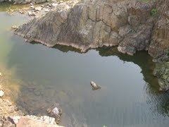
It is a sub-division (upkhand) in Udaipur district located at just 80 km from Rajasthan-Gujarat border. Ahmedabad, the capital of Gujarat, is located at a distance of 170 km. The town is located in Aravali ranges and small hills are ubiquitous. The area is surrounded by Aravali hill ranges from north to south and is covered with rocky hills which are well stocked with forests. The forests which constitute an invaluable source of income partly sustain the economy of the local tribal inhabitants. The topography of the area is represented by medium to high rocky hills, contours and plains.
The area is characterized as being semi-arid with an average annual rainfall of about 650 mm, which is mainly received during the monsoon season from July to September. The minimum temperature in winter goes up to 2 °C and maximum 25 °C, while in summer, it goes up to minimum 20 °C and maximum 42 °C. Relative humidity in the area is above 70% during monsoon months but is below 20% during the months of March through May. The average rainfall of the area is about 624.5 mm.
The area is particularly rich in minerals resources like green marble (serpentinite), soapstone and asbestos found in the area. Green marble and soapstone mining are carried out through semi-mechanized and manual methods by private company in this region.
Connectivity
It is located on NH-8 which connects Mumbai and Delhi. The distance from Delhi is 750 km and from Mumbai is 700 km. The town is well connected by the services of Rajasthan state road transport services. The nearest railway station is Dungarpur at a distance of 23 km. Udaipur railway station is at distance of 80 km and trains are available for major routes. The nearest airport is Dabok at distance of 100 km and Ahmedabad at 160 km.
