
Purpose Water supply, power Opening date 1964 Height 47 m Surface area 125 km² | Location Khashm El Girba Status Operational Catchment area 112,400 km² Construction began 1960 | |
 | ||
Similar Tekezé Dam, Jebel Aulia Dam, Sennar Dam, Roseires Dam, Sondu Miriu Hydroele | ||
The Khashm el-Girba Dam is a gravity and embankment composite dam on the Atbarah River about 4 km (2 mi) south of Khashm El Girba in Eastern Sudan. The primary purpose of the dam is irrigation.
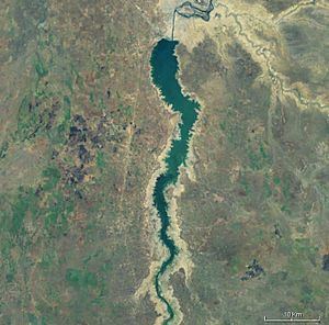
Map of Khashm el-Girba Dam, Sudan
The dam is equipped with canal headworks, located on its left bank, which divert water into a canal. When water levels in the reservoir are low, three pumps move water into the canal.
The main portion of the dam is an earthen embankment; the spillway and irrigation headworks sections are concrete gravity. The dam has a small hydroelectric power station, which was upgraded during the period 2002-04 to its current installed capacity of 10 megawatts (13,000 hp).
References
Khashm el-Girba Dam Wikipedia(Text) CC BY-SA