
Height 78 m (256 ft) Opened 1966 | Opening date 1966 Length 24,410 m (80,090 ft) Construction began 1961 | |
 | ||
Total capacity 7.4 km (5,999,278 acre·ft) Surface area 29,000 ha (71,661 acres) Similar Sennar Dam, Merowe Dam, Jebel Aulia Dam, Khashm el‑Girba Dam, Upper Atbara and Setit Dam | ||
Roseires dam sudan 1966
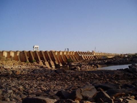
The Roseires Dam (Arabic: خزان الروصيرص) is a dam on the Blue Nile at Ad Damazin, just upstream of the town of Er Roseires, in Sudan. It consists of a concrete buttress dam 1 km wide with a maximum height of 68m, and an earth dam on either side. The earth dam on the eastern bank is 4 km long, and that on the western bank is 8.5 km long. The reservoir is about 290 km2.
Contents
Map of Roseires Dam, Sudan
The dam was completed in 1966, initially for irrigation purposes. A power generation plant, with a maximum capacity of 280 megawatts, was added in 1971. A heightening (and lengthening) project was completed in 2013 and the dam is now 25 km long.
References
Roseires Dam Wikipedia(Text) CC BY-SA