
Country United States GNIS feature ID 453525 Local time Sunday 4:00 PM | FIPS code 18-39636 Elevation 269 m Population 7,666 (2010) | |
 | ||
Weather 0°C, Wind W at 3 km/h, 37% Humidity Area 62.21 km² (62.06 km² Land / 13 ha Water) Points of interest Early Ford V‑8 Foundati, National Military History C, Feick Park | ||
Keyser Township is one of fifteen townships in DeKalb County, Indiana. As of the 2010 census, its population was 7,666 and it contained 3,087 housing units.
Contents
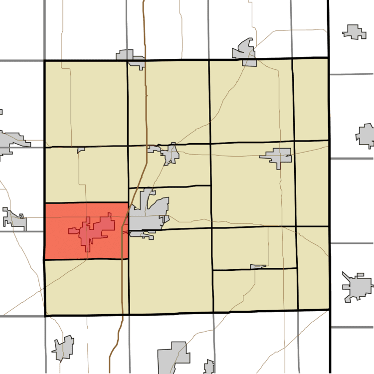
- Map of Keyser Township IN USA
- History
- Geography
- Cities and towns
- Adjacent townships
- Major highways
- Cemeteries
- References
Map of Keyser Township, IN, USA
History
Keyser Township had its start in the year 1876 by the building of the railroad through that territory.
The Samuel Bevier House, Joseph Bowman Farmhouse, Breechbill-Davidson House, Brethren in Christ Church, Orin Clark House, DeKalb County Home and Barn, William Fountain House, Gump House, Edward Kelham House, Charles Lehmback Farmstead, Rakestraw House, and Henry Shull Farmhouse Inn were added to the National Register of Historic Places in 1983.
Geography
According to the 2010 census, the township has a total area of 24.02 square miles (62.2 km2), of which 23.96 square miles (62.1 km2) (or 99.75%) is land and 0.05 square miles (0.13 km2) (or 0.21%) is water.
Cities and towns
Adjacent townships
Major highways
Cemeteries
The township contains two cemeteries: Calvary and Embrey.