
Founded 1861 | Area 15,452 km² Population 2,191 (2013) | |
 | ||
Website www.keweenawcountyonline.org Rivers Trap Rock River, Traverse River, Hills Creek, Silver Creek Points of interest Fort Wilkins, Isle Royale National Park, Copper Harbor Light, Eagle Harbor Light, Hunter's Point Park Destinations | ||
Keweenaw County is a county in the Upper Peninsula of the U.S. state of Michigan, the state's northernmost county. As of the 2010 census, the population was 2,156, making it Michigan's least populous county. It is also the state's largest county by total area (including waters of Lake Superior). The county seat is Eagle River.
Contents
- Map of Keweenaw County MI USA
- Geography
- National protected area
- Major highways
- Adjacent counties and district
- Demographics
- Politics
- Government
- Elected officials
- Villages
- Census designated places
- Other unincorporated communities
- Townships
- References
Map of Keweenaw County, MI, USA
The county was set off and organized in 1861. It is believed "Keweenaw" is a Native American word that means "portage or place where portage is made". Keweenaw County is part of the Houghton, Michigan, Micropolitan Statistical Area. Isle Royale, a national park which no longer has year-round inhabitants, was a separate county that was incorporated into Keweenaw County in 1897.
Geography
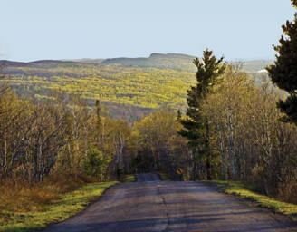
Two land masses comprise most of the land portion of the county: Isle Royale and the northeastern half of the Keweenaw Peninsula. The county also includes the waters of Lake Superior between the two, extending to the state's water borders with Ontario and Minnesota. It is thus the largest county in Michigan by total area, at 5,966 square miles (15,450 km2), of which 540 square miles (1,400 km2) is land and 5,426 square miles (14,050 km2) (91%) is water. Of all counties (or equivalents) in the United States, Keweenaw County has the highest proportion of water area to total area.
The largest lake entirely within the county is Gratiot Lake at 1,438 acres (5.82 km2), located at the base of the county's two highest peaks: Mt. Horace Greeley at 1,550 feet (470 m) and Mt. Gratiot at 1,490 feet (450 m). Other lakes include Lac La Belle near Bete Grise Bay, Lake Medora, Lake Fanny Hooe near Copper Harbor, Lake Bailey at the base of Mt. Lookout, and Schlatter Lake at the tip of the peninsula.
National protected area
Major highways
Adjacent counties and district
Demographics
The 2010 United States Census indicates Keweenaw County had a population of 2,156. This is a decrease of 145 people from the 2000 United States Census, or a -6.3% change in population. In 2010 there were 1013 households and 614 families in the county. The population density was 4 people per square mile (2/km²). There were 2,467 housing units at an average density of 4 per square mile (2/km²). 98.5% of the population were White, 0.1% Black or African American, 0.1% Native American and 1.2% of two or more races. 0.7% were Hispanic or Latino (of any race). 38.8% were of Finnish, 14.0% German, 9.0% English, 6.6% French, French Canadian or Cajun and 5.7% Irish ancestry.
There were 1013 households out of which 16.8% had children under the age of 18 living with them, 52.4% were married couples living together, 4.9% had a female householder with no husband present, and 39.4% were non-families. 34.2% of all households were made up of individuals and 15.0% had someone living alone who was 65 years of age or older. The average household size was 2.12 and the average family size was 2.71.
In the county, the population was spread out with 17.9% under the age of 18, 5.2% from 18 to 24, 20.0% from 25 to 44, 36.0% from 45 to 64, and 24.1% who were 65 years of age or older. The median age was 51.6 years. The population is 51.3% male and 48.7% female.
The median income for a household in the county was $39,821, and the median income for a family was $48,563. The per capita income for the county was $21,218. About 16.6% of families and 17.8% of the population were below the poverty line, including 34.2% of those under age 18 and 4.0% of those age 65 or over.
Politics
Keweenaw County has a somewhat unusual political history. In its early years it was like most of Michigan before Franklin Delano Roosevelt solidly Republican: indeed in 1900, 1904 and 1908 it stood as the nation's most Republican county. In his last election of 1944, Roosevelt became the first Democrat to win the county since Horatio Seymour in 1868. However, from 1964 to 1996 Keweenaw voted Democratic in every election except 1972 and 1980, thus standing as one of only six counties nationwide to support both Alf Landon and Walter Mondale, who suffered the two worst electoral vote losses since 1824. Since 2000, the county has become solidly Republican again.
Government
The county government operates the jail, maintains rural roads, operates the major local courts, keeps files of deeds and mortgages, maintains vital records, administers public health regulations, and participates with the state in the provision of welfare and other social services. The county board of commissioners controls the budget but has only limited authority to make laws or ordinances. In Michigan, most local government functions—police and fire, building and zoning, tax assessment, street maintenance, etc.—are the responsibility of individual cities and townships.
The Keweenaw County Courthouse and Sheriff’s Residence and Jail in Eagle River faces Lake Superior. The courthouse was built in 1866, followed by the sheriff’s residence and jail in 1886, and then remodeled in 1925. In her book Buildings of Michigan, Eckert writes:
“Like a meetinghouse on a New England public square, and enclosed by a 3-foot [0.91 m] high public wall on the east and south sides, ...transformed in 1925 into its present stark white classical appearance. The courthouse for this sparsely populated remote county is remarkable in its formality...These include the giant Doric columns with fillets and bases, a pediment forming a projecting portico, a modillioned cornice, and pedimented side dormers.” (p.481)The courthouse still preserves its original appearance.
Sparsely-populated Keeweenaw County was a mining center in the later 19th century but in the 20th century turned into a resort community. Because of this trend, Keweenaw County is also the only Michigan county to have a lower population in the year 2000 than in 1900.
Elected officials
(information as of October 2014)