
Population 10,374 (2011 census) Postcode(s) 2440 Postal code 2440 | Established 1836 Elevation 2.3 m Local time Sunday 11:16 AM | |
 | ||
Weather 26°C, Wind N at 6 km/h, 48% Humidity | ||
Kempsey is a town in the Mid North Coast region of New South Wales, Australia and is the council seat for Kempsey Shire. It is located 15 kilometres inland from the coast of the Pacific Ocean where the Pacific Highway and the North Coast railway line cross the Macleay River. It is roughly 345 kilometres north of Sydney.
Contents
- Map of Kempsey NSW 2440 Australia
- European settlement
- Floods
- Economy
- Facilities
- Transport
- Primary schools
- High schools
- Notable people
- Newspapers
- References
Map of Kempsey NSW 2440, Australia
European settlement
Enoch William Rudder is credited with founding the settlement. He arrived from Birmingham in 1834 and bought land on the southern bank of the river in 1836, at what was then the limit of authorized settlement (the boundary of County Macquarie). He was initially attracted by red cedar cutting opportunities but planned also to profit by selling parts of his land. He had riverside blocks surveyed and established a private town, with the first blocks sold in November 1836. He called it Kempsey because the surrounding areas reminded him of the Kempsey Valley in Worcestershire. The collapse in red cedar prices in the early 1840s nearly led to the failure of the town.
The main (and most flood-prone) part of Kempsey was founded by John Verge, sub-dividing a grant on the flood-plain opposite Rudder's settlement. In 1854, a government town was surveyed at West Kempsey and government facilities moved there when it became clear that no town would form around the police station and courthouse at Belgrave Falls. Rudder's settlement was renamed East Kempsey.
Kempsey initially flourished as a centre for logging and sawmilling. Large reserves of Australian red cedar Toona australis, sold in Britain and the USA (as 'Indian mahogany') were extracted down until the 1920s, and with greater difficulty until the 1960s, by which time the resource was effectively exhausted. Dairying was the major industry in the area until the 1960s, with a Nestlé Milo factory at nearby Smithtown, and several cheese and butter factories.
Floods
Geographically, Kempsey stretches out around a long loop of the Macleay River at the top of the flood-plain. It is famous for its floods. The 1949 flood was particularly destructive, having washed a large part of the town centre away when the railway viaduct which was acting as a dam-wall due to a build-up of debris against the railway bridge gave way. The area most affected by this flood is now the site of playing fields. The shire council has a policy of buying up land in areas designated as flood plains and many houses have been transported to higher ground in recent years. Other major floods occurred in 1949, 1950, 1963, 2001, 2009, 2013.
Economy
Despite a period of economic stagnation in past decades compared to nearby coastal centres of growth, Kempsey has a growing local economy based on tourism, farming and service industries. As a local centre it has many shops and services including three major supermarkets, a department store and fast food chain stores such as Subway.
In 2014, the Australian Bureau of Statistics ranked Kempsey as one of the poorest Local Government areas in New South Wales.
A Coles supermarket development (known as the "Kempsey Central Shopping Centre") has been built and is situated where the Tattersalls Hotel and various small businesses were in Little Belgrave Street. This shopping centre opened on 6 December 2008.
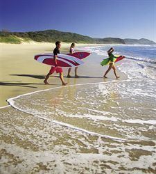
Growing industries include wineries and nut production. Kempsey is a service centre for the nearby coastal resorts of South West Rocks, Arakoon, Hat Head, and Crescent Head, which are popular places for retirees and holiday-makers alike.
With two McDonald's, two Subway, one KFC, one Dominoes, one Eagle Boys, 5 individual fast food restaurants, 8 pubs and 7 liquor stores.
Facilities
Government buildings such as the council chambers, library and several offices - are located west of the North Coast Railway line in West Kempsey. This area is not subject to the flooding that the CBD occasionally sees and is seen as a second business district with a variety of businesses and banking facilities. Opened in July 2004, the Mid North Coast Correctional Centre, a minimum to medium prison for 500 male and female inmates, is located in Aldavilla, approximately 14 kilometres (8.7 mi) west of Kempsey. There is plans to add extra housing for more inmates by 2020.
Transport
Until a new 14.5 kilometre bypass opened on 27 March 2013, the Pacific Highway passed through Kempsey. The new bypass included a 3.2 kilometre Macleay River Bridge, the longest bridge in Australia.
Kempsey railway station is located on the North Coast line providing a connection to Sydney and Brisbane.
Primary schools
High schools
Notable people
Newspapers
The Macleay Argus is the local newspaper for Kempsey and other nearby towns in the Macleay Valley area. It is published every Tuesday and Friday by Fairfax Media.