
Native name Kelani Ganga | Length 145 km Bridges McCallum Lock Gates | |
 | ||
River mouth Colombo, Indian Ocean0 m (0 ft) Discharge Average rate:Dry seasons: 20–25 m/s (710–880 cu ft/s)Monsoon seasons: 800–1,500 m/s (28,000–53,000 cu ft/s) Sources Horton Plains National Park, Adam's Peak Similar Kelaniya Raja Maha Vihara, Adam's Peak, Horton Plains National, Beira Lake, Pinnawala Elephant Orphanage | ||
About kelani river part 01
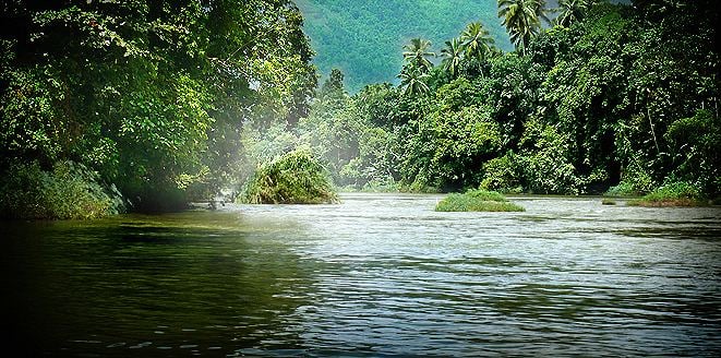
The Kelani River (Sinhalese: කැළණි ගඟ) is a 145-kilometre-long (90 mi) river in Sri Lanka. Ranking as the fourth-longest river in the country, it stretches from the Sri Pada Mountain Range to Colombo. It flows through or bordering the Sri Lankan districts of Nuwara Eliya, Ratnapura, Kegalle, Gampaha and Colombo.
Contents
- About kelani river part 01
- Map of Kelani Ganga Sri Lanka
- HydrologyEdit
- Hydrometry and usageEdit
- Special featuresEdit
- Bridges over Kelani RiverEdit
- References
Map of Kelani Ganga, Sri Lanka
HydrologyEdit
Kelani River has two main tributaries in its upper reaches. These are; (1) Kehelgamu Oya and (2) Maskeli Oya. These two contribute to part of hydro-electric production in Sri Lanka, by housing several major reservoirs, ponds and power stations. Castlereigh Reservoir and Norton Reservoir are constructed across Kehelgamu Oya, while Maskeliya Reservoir, Canyon Reservoir and Laxapana Reservoir are constructed across Maskeli Oya. In its lower reaches, some more tributaries connect to Kelani River out of which the most famous are We Oya at Yatiyanthota, Gurugoda Oya at Ruwanwella and Seethawaka Ganga at Avissawella.
Hydrometry and usageEdit
It supplies approximately 80% of the water used in Colombo. In addition, the river is used for transport, fisheries, sewage disposal, sand mining and for production of hydroelectricity. Through these factors, many people depend on the river for their daily routine in life. Depending on the operation of three reservoirs, the river flow varies from 20 m3/s (706 cu ft/s) to 25 m3/s (883 cu ft/s) in the dry seasons, and 800 m3/s (28,252 cu ft/s) to 1,500 m3/s (52,972 cu ft/s) during the monsoons. The annual sand extraction from the river is approximately 600,000 m2 (6,458,346 sq ft) to 800,000 m2 (8,611,128 sq ft). From a barge, people dive to the river bed, from where the sand is lifted to the barge in a bucket, and when the barge is full, it is taken to the river bank and unloaded by a separate team. The sand mining causes the river bed to sink by approximately 10 cm (4 in) per year. At present, two main concerns in connection with the river are flooding during the monsoon and saline intrusion in the dry season.
In addition, Kelani River water levels affect the flood risk to Colombo, capital of Sri Lanka, to a considerable extent. One reason is that part of the city and suburbs of Colombo lie on the lower flood plain of the river. Exposure of Colombo and upper catchments of Kelani River to the same monsoon, i.e. South West Monsoon, is another reason.
The problems are related: the saline intrusion is enhanced by the deepening of the river caused by the sand mining. Regulation in order to prevent the saline intrusion can reduce the water quality in other ways, and can increase the flood risk. Sand mining is economically important nationally and to the many involved people.
The Kelani stream flow was investigated just upstream of Ambatale at Hanwella, analyzing the river discharges from 1973 to 2004 (in million m³/month).
Special featuresEdit
The Academy Award-winning The Bridge on the River Kwai was filmed on the Kelani River near Kitulgala, although nothing remains now except the concrete foundations for the bridge (and, supposedly, the submerged train cars that plunged into the river in the climactic scene).
Bridges over Kelani RiverEdit
The following table shows the major bridges over Kelani River: