
Region Mangystau Region | ||
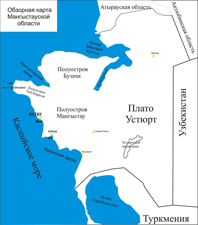 | ||
The Kaydak Inlet or Sor Kaydak (Russian: Залив Кайдак) is a narrow inlet or arm at the eastern end of the Dead Kultuk (former Komsomolets), a bay of the Caspian Sea in the coast of Kazakhstan. Located at the mainland end of the bay, it forms the eastern limit of the Buzachi Peninsula, at the north of the Mangyshlak Peninsula. The inlet is shallow and cuts deep into the coast extending east and then roughly southwards in a SSW direction. Like all shallow gulfs of the eastern shores of the Caspian, it has a high salinity.
In the same manner as the Dead Kultuk, the Kaydak Inlet had a distinct coastline in former times, but since the 1990s, with higher Caspian Sea levels, the water penetrates inland through the neck of the bay producing waterlogged marshes. Nowadays both the bay and the inlet are filled with Caspian Sea water. The water in the shallow inlet has striking colours, in which delicate tones of blue or of brown predominate according to the seasons.
Cartography
The area was cartographed by Fedor Ivanovich Soimonov during the Caspian Expedition, which surveyed the Caspian Sea from 1719 to 1727, but was only accurately described later by G. S. Karelin in 1832.