
Local time Saturday 6:11 PM | Region ChūbuTōkai - Tree Sakura Area 100.8 km² Population 7,569 (Sep 2014) | |
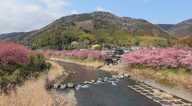 | ||
Weather 7°C, Wind NE at 26 km/h, 64% Humidity Points of interest iZoo, Mineonsen Daifunto Park, Kawazu Nanadaru loop bridge, Imaihama Hot Spring, Kawazu‑zakura Cherry Blossom | ||
Kawazu (河津町, Kawazu-chō) is a town located on the east coast of Izu Peninsula in Kamo District, Shizuoka Prefecture, Japan.
Contents
- Map of Kawazu Kamo District Shizuoka Prefecture Japan
- Geography
- Neighbouring municipalities
- History
- Economy
- Highway
- Railway
- References
Map of Kawazu, Kamo District, Shizuoka Prefecture, Japan
As of September 2014, the town had an estimated population of 7,569 and a population density of 75.1 persons per km². The total area was 100.79 km².
Geography
Kawazu occupies a portion of the eastern coastline of Izu Peninsula, facing Sagami Bay and the Pacific Ocean. It is bordered to the west by the Amagi Mountains. The town has a temperate maritime climate characterized by hot summers and short cool winters, with the weather moderated by the effects of the warm Kuroshio current offshore. Parts of the town are within the limits of the Fuji-Hakone-Izu National Park. The area is noted for a large number of hot springs.
Neighbouring municipalities
History
During the Edo period, the area around Kawazu was tenryō territory controlled directly by the Tokugawa shogunate or various hatamoto. During the cadastral reform of 1889, the village of Kawazu was created, along with Kamikawazu and Shimokawazu through the merger of 15 small hamlets within Kamo District. The town of Kawazu was created through the merger of the villages of Kamikazu and Shimokawazu in September 1958.
Around March 31, 2010, the city of Shimoda and three municipalities in Kamo District (Kawazu, Matsuzaki, and Minamiizu) were scheduled to merge. However, the merger backed out.
Economy
The local economy is based on farming and tourism centered on hot spring resorts.