
Country Canada Area 3,059 km² | Province Ontario Formed by political merger January 1, 2001 Time zone EST (UTC-5) Population 73,214 (2011) | |
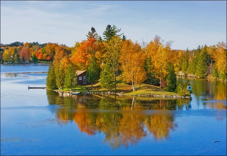 | ||
Weather -17°C, Wind NW at 6 km/h, 72% Humidity Points of interest Balsam Lake Provincial, Trent–Severn Waterway, Kawartha Lakes, Balsam Lake, Lake Scugog | ||
The city of Kawartha Lakes (2011 population 73,214) is a unitary municipality in Central Ontario, Canada. It is a municipality legally structured as a single-tier city; however, Kawartha Lakes is the size of a typical Ontario county and is mostly rural. It is the second largest single-tier municipality in Ontario by land area.
Contents
- Map of Kawartha Lakes ON Canada
- History
- Population trends
- Census Division rankings
- Ethnocultural and racial statistics
- Communities
- Victoria County
- Townships
- Incorporated communities
- Air transportation
- Water transportation
- Land transportation
- Public transportation
- Bus companies
- Train routes
- Taxi services
- Carvan pools
- Attractions
- Protected areas
- Media
- Surrounding counties
- References
Map of Kawartha Lakes, ON, Canada
The main population centres are the communities of Bobcaygeon, Fenelon Falls, Lindsay, Omemee and Woodville.
History
The city's name comes from the name of the Kawartha lakes. The term Kawartha is an anglicization of the word Ka-wa-tha (from Ka-wa-tae-gum-maug or Gaa-waategamaag, meaning), a word coined in 1895 by aboriginal Martha Whetung of the Curve Lake First Nations. The word meant "land of reflections" in the Anishinaabe language, according to Whetung. The word was later changed by tourism promoters to Kawartha, meaning "bright waters and happy lands."
Prior to its restructuring as a city, the area was known as Victoria County. The city was created in 2001, during the ruling provincial Progressive Conservative party's "Common Sense Revolution". Through provincial legislation, the former Victoria County and its constituent municipalities were amalgamated into one entity named the City of Kawartha Lakes.
This act was implemented by the Victoria County Restructuring Commission, led by commissioner Harry Kitchen. Despite a general opposition from residents of the area, the provincial government pushed forward with the amalgamation, which officially came into effect on January 1, 2001.
By a narrow margin (51% for, 49% against), the citizens of Kawartha Lakes voted to de-amalgamate in a November 2003 local plebiscite, but the provincial and municipal governments have not taken any steps since the vote to initiate de-amalgamation.
Population trends
In 2011 census, the population of the Lindsay urban area was 20,354, up from 19,361 in 2006.
Census Division rankings
National rank in terms of population (2011): 74
Provincial rank in terms of population (2011): 34
Ethnocultural and racial statistics
Only ethnic groups that comprise greater than 1% of the population are included. Note that a person can report more than one group
Communities
The following is a list of all the former incorporated villages, unincorporated hamlets and communities, rural post offices, and rural post offices abandoned after the start of rural mail delivery.
Victoria County
Prior to 2001, Victoria County consisted of 13 separate townships and 6 incorporated villages with their own local governments:
Townships
Population centres:
The township of Laxton, Digby and Longford is an amalgamation of the once individual townships of Digby and Laxton, and half of the original Longford Township. The separate township of Longford is uninhabited, though dotted with abandoned logging towns. In 2000, just prior to amalgamation into the city of Kawartha Lakes, the township of Verulam and the village of Bobcaygeon were amalgamated into the Municipality of Bobcaygeon/Verulam.
Incorporated communities
Air transportation
Kawartha Lakes Municipal Airport, a Transport Canada certified airport, has 24-hour radio operated lighting and provides access to key points throughout Ontario. Kawartha Lakes Municipal Airport is located one nautical mile west north west of Lindsay. It offers a card lock fuel system and can be used by both private and commercial airplanes.
Water transportation
Towns and villages in City of Kawartha Lakes are interconnected by rivers, lakes and streams that can be best navigated May to October. The Trent-Severn Waterway, which extends from Bay of Quinte on Lake Ontario to Georgian Bay in the north, is part of the waterways in City of Kawartha Lakes. Five locks, Bobcaygeon 32, Lindsay 33, Fenelon Falls 34, Rosedale 35, and Kirkfield 36 are part of the Trent-Severn National HistoricSsite and operated by Parks Canada. Coboconk is noted as being Canada's fresh water summit with waters flowing two different directions. It is the highest navigable point in Canada from which it is possible to reach the world. There are no water taxis operating in City of Kawartha Lakes. Boat and houseboat rentals are available.
Land transportation
The following King's Highways pass through the city:
The following multi-use trails pass through the city:
Public transportation
Because of the largely rural composition of the City of Kawartha Lakes, there is limited public transportation. City of Kawartha Lakes has public bus transit in the town of Lindsay only (known as Lindsay Transit), running three lines of hourly service Monday-Saturday from 7am-7pm.
On June 21, 2015 the pilot project rural bus route serving part of City of Kawartha Lakes ended service. The rural bus stopped in Lindsay, Dunsford, Bobcaygeon, Fenelon Falls, and Cameron.
Most school children are bussed to elementary and high school.
Bus companies
CanAr Bus Lines offers service between Toronto and Haliburton with nine stops in City of Kawartha Lakes - Yelverton, Highway 7 and 35, Lindsay Inn, William and Kent in Lindsay, Cameron, Rosedale, Fenelon Falls, Coboconk and Norland.
Train routes
The last Canadian National Railway (CN) train to run through City of Kawartha Lakes was on the Lindsay - Uxbridge line which ceased operation in 1991.
The last passenger train to run through the City of Kawartha Lakes was No. 189 with Budd Car VIA 6104 from Havelock to Toronto Union Station over Canadian Pacific Railway (CP) lines on January 14, 1990.
CP freight trains continue to operate through the City of Kawartha Lakes on the Havelock Subdivision (MP 133.23 - MP 143.22) which passes through Pontypool (MP 139.1)
High-level discussions organized by the Shining Waters Railway continue about returning passenger rail-service to the Midtown Toronto to Havelock line with a stop in Pontypool.
The Trans Canada Trail which is situated on the old rail line from Uxbridge, continues to be a possibility for commuter service to Toronto and Pearson Airport, from the Highway 7 bridge.
Taxi services
There are several private taxi services in City of Kawartha Lakes licensed by the local government.
Car/van pools
Several businesses and organizations offer car and van pooling through Car Pool World including Sir Sandford Fleming College.