
Area 44.56 km² Local time Saturday 5:29 PM | Population 10,657 (2016) | |
 | ||
Time zone Japan Standard Time (UTC+9) Weather 9°C, Wind N at 11 km/h, 57% Humidity Points of interest Ushikiriyama, Kure Dam, Kibe Pass, Iidakeyama, Ninotake, Sannodake | ||
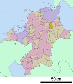
Kawara (香春町, Kawara-machi) is a town located in Tagawa District, Fukuoka Prefecture, Japan.
Map of Kawara, Tagawa District, Fukuoka Prefecture, Japan
As of 2016, the town has an estimated population of 10,657 and a density of 240 persons per km². The total area is 44.56 km².
References
Kawara, Fukuoka Wikipedia(Text) CC BY-SA