
Country Namibia Population 222,500 (2011) University St Boniface college | Area 48,742 km² | |
 | ||
Time zone South African Standard Time: UTC+1 | ||
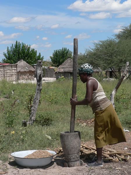
Amazing namibian dance kavango region
Kavango (before 1998: Okavango) was one of the thirteen Regions of Namibia until it was split into the Kavango East and Kavango West Regions in 2013. Its capital was Rundu.
Contents
- Amazing namibian dance kavango region
- Map of Kavango Region Namibia
- Kavango region namibia 00026
- Politics
- Population
- Economy and infrastructure
- Transport
- References
Map of Kavango Region, Namibia
In the north, Kavango bordered the Cuando Cubango Province of Angola, and in the southeast the North-West District of Botswana. Domestically, it bordered the following regions:
Because of its rather higher rainfall than most other parts of Namibia, this region had agricultural potential for the cultivation of a variety of crops, as well as for organised forestry and agro-forestry, which stimulated furniture making and related industries.
Kavango region namibia 00026
Politics
The region was subdivided into nine electoral constituencies: Mpungu, Kahenge, Kapako, Rundu Rural West, Rundu Urban, Rundu Rural East, Mashare, Ndiyona, and Mukwe.
Ambrosius Haingura, a prominent SWAPO organizer during the Namibian War of Independence, served as the region's first Regional Governor from 1993 to 1995. Maurus Nekaro, the Governor of Kavango Region from December 2010, died in office on March 4, 2013. Samuel Mbambo was appointed as Kavango's last Governor in April 2013.
The Fourth Delimitation Commission of Namibia, responsible for recommending on the country's administrative divisions suggested in August 2013 to split the Kavango Region into two. The president Hifikepunye Pohamba enacted the recommendations. As a result, the new Regions of Kavango East and Kavango West have been created.
Population
The region was characterised by an extremely uneven population distribution. The interior is very sparsely inhabited, while the northernmost strip, especially along the Kavango River, has a high population concentration. Largest urban settlements were the capital Rundu and the towns of Nkurenkuru and Divundu.
Economy and infrastructure
Kavango was the region with the highest poverty level in Namibia, more than 50% of the population were classified as poor. According to the 2012 Namibia Labour Force Survey, unemployment in the Kavango Region is 29.8%. Economic activities included farming and tourism. Subsistence fishing also played a role in the nutrition of the people residing near the Kavango River.
Kavango had 323 schools with a total of 77,314 pupils.
Transport
There was a particular dearth of north-south roads in the Region, apart from the Rundu-Grootfontein main road. Rundu has a small airstrip to accommodate medium-sized tourist or cargo aircraft in daylight only. The poor condition of the roads and the long distances had a negative effect on tourism; this situation was improved by the completion of the Trans–Caprivi Highway. A major highway connecting Rundu to western Kavango and the Ohangwena Region is under construction.