
- Tree Japanese Chestnut Population 41,715 (Sep 2015) Bird Japanese bush warbler | Region Kantō Area 118.8 km² Local time Saturday 8:28 AM | |
 | ||
Points of interest Lake Kasumigaura, Ayumizaki Forest Park, Yukiirifureainosato Park, Ayumizaki‑kannon Temple | ||
Kasumigaura (かすみがうら市, Kasumigaura-shi) is a city located in Ibaraki Prefecture, in the northern Kantō region of Japan. As of September 2015, the city had an estimated population of 41,715 and a population density of 266 persons per km². Its total area was 156.60 square kilometres (60.46 sq mi). The city takes its name from the nearby lake, Lake Kasumigaura. The city has the distinction of having the longest name in Japan (in terms of the number of characters used), together with Ichikikushikino and Tsukubamirai. Much of the city is within the borders of the Suigō-Tsukuba Quasi-National Park.
Contents
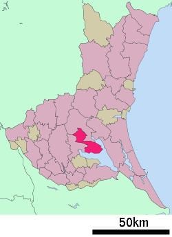
- Map of Kasumigaura Ibaraki Prefecture Japan
- Geography
- Surrounding municipalities
- History
- Economy
- Education
- Railway
- Highway
- Notable people from Kasumigaura
- References
Map of Kasumigaura, Ibaraki Prefecture, Japan
Geography
Kasumigaura is located in central Ibaraki Prefecture, on a peninsula bordered by Lake Kasumigaura on two sides to the southeast and southwest. It is approximately 60 kilometers to the northeast of Tokyo.
Surrounding municipalities
History
The village of Dejima was established within Niihari District on February 11, 1955 through the merger of the villages of Shimootsu, Minami, Ushiwata, Saga, Anshoku and Shishiko. It was elevated to town status on April 1, 1997 and was renamed Kasumigaura.
The town of Kasumigaura merged with the neighboring town of Chiyoda on March 28, 2005, becoming the city of Kasumigaura.
Economy
Kasumigaura has primarily an agricultural economy, with lotus root, and various fruits as the major cash crops. Aquaculture on Lake Kasumigaura also plays a role.
Education
Kasumigaura has 14 elementary schools, three middle schools, and one high school.