Sneha Girap (Editor)

Kasrawad

Updated on
Edit
Like
Comment
Share on FacebookTweet on TwitterShare on LinkedInShare on Reddit
Country
  
Language spoken
  
Hindi

State
  
District
  

Kasrawad is a town and nagar panchayat in Khargone district in the Indian state of Madhya Pradesh.

Contents

Map of Kasrawad

Demographics

As of 2001 India census, Kasrawad had a population of 19,035. Males constitute 51% of the population and females 49%. Kasrawad has an average literacy rate of 57%, lower than the national average of 59.5%: male literacy is 66%, and female literacy is 48%. In Kasrawad, 16% of the population is under the age of 6 years.

Geography
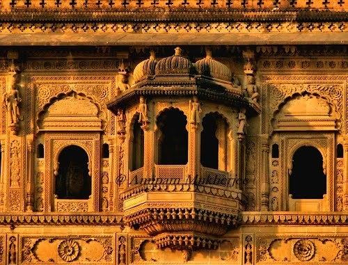
Kasrawad Beautiful Landscapes of Kasrawad

Kasrawad is located at 22.13°N 75.6°E? / 22.13; 75.6. It has an average elevation of 169 metres (554 feet) and is 17 km in east from National Highway 3 (Agra to Mumbai) and about 100 km from Indore. The town is only 5 km away from the northern banks of the Holy Narmada River.

Economy

Maheshwar near Kasravad is noted as a center for weaving colorful cotton saris, with distinctive designs involving stripes, checks and floral borders. Additionally, other material used for making kurts etc. are also made here.

Culture

There are lots of places to visit in Kasrawad: the Bhavani Mata Temple, ancient Kailask kund and Baba ki Mazar on Gangleshwar parvat are a few. Every year the Gangaleshver Fair is organised by Nagar Panchayat during the winter months. There is a cinema hall "New Nimar Talkies" in the town. Kasrawad is famous for its Band parties.

References

Kasrawad Wikipedia (,)http://mw2.google.com/mw-panoramio/photos/medium/78606913.jpg(,)http://mw2.google.com/mw-panoramio/photos/medium/4729175.jpg(,)http://mw2.google.com/mw-panoramio/photos/medium/85186817.jpg(,)http://mw2.google.com/mw-panoramio/photos/medium/26233177.jpg(,)https://sandrp.files.wordpress.com/2014/04/intake-well-at-kasrawad-last-intake-hole-is-above-the-water-level.jpg%3Fw%3D1080(,)https://sandrp.files.wordpress.com/2014/04/narmada-river-be-between-kasrawad-and-rajghat.jpg%3Fw%3D1080(,)http://mw2.google.com/mw-panoramio/photos/medium/78988697.jpg(,)http://www2.robertharding.com/preview/RM/RH/HORIZONTAL/1030-67341.jpg(,)https://c1.staticflickr.com/5/4037/4408477813_27a7c6762f_z.jpg%3Fzz%3D1(,)http://i.ytimg.com/vi/WS2Bm8Wi8CY/0.jpg(,)http://i.ytimg.com/vi/ZjTH5l0wwOk/0.jpg(,)http://i.ytimg.com/vi/I-buEXtFwrE/0.jpg(,)http://i.ytimg.com/vi/8RTvJgnPDOM/0.jpg(,)http://tourmet.com/wp-content/uploads/2014/09/Bhawani-Mata-Temple-Kasrawad.jpg(,)http://i.ytimg.com/vi/IupTPBnN1Uk/0.jpg(,)http://thumbs.dreamstime.com/z/lord-shiva-parvati-madhya-pradesh-ancient-stone-carvings-ganesha-worshipped-as-deities-hindu-religion-culture-38751817.jpg(,)http://photos.wikimapia.org/p/00/00/96/13/75_big.jpg(,)http://allthecities.com/system/panoramas/pictures/000/907/135/original/original.%3F1380288389(,)https://upload.wikimedia.org/wikipedia/commons/thumb/e/e4/Madhya_Pradesh_districts_location_map_big.svg/500px-Madhya_Pradesh_districts_location_map_big.svg.png(,)http://www.maraloverseas.com/images/manufacturing/unit_sarovar_large.jpg(,)http://i1.ytimg.com/vi/DnC43rdG4y8/0.jpg


Similar Topics