
Country United States GNIS feature ID 1413283 Zip code 99610 Area code 907 | State Alaska FIPS code 02-38090 Elevation 38 m Population 549 (2010) | |
 | ||
Area 27.45 km² (26.94 km² Land / 52 ha Water) Borough Kenai Peninsula Borough, Alaska | ||
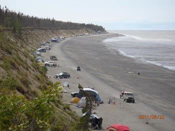
Tustumena lake boat launch primitive camping tustumena lake road kasilof alaska
Kasilof (/kəˈsiːlɒf/ kə-SEE-lof) is a census-designated place (CDP) in Kenai Peninsula Borough, Alaska, United States. At the 2010 census the population was 549.
Contents
- Tustumena lake boat launch primitive camping tustumena lake road kasilof alaska
- Map of Kasilof AK 99610 USA
- Approaching giant porch swing kasilof alaska
- Geography
- Demographics
- History
- References
Map of Kasilof, AK 99610, USA
Approaching giant porch swing kasilof alaska
Geography
Kasilof is located at 60°20′7″N 151°14′1″W (60.335274, -151.233594).
Kasilof is on the east side of the Cook Inlet on the Kenai Peninsula, on the Sterling Highway, 19 km (12 mi) south Kenai on the Kasilof River.
According to the United States Census Bureau, the CDP has a total area of 10.6 square miles (27 km2), of which, 10.4 square miles (27 km2) of it is land and 0.2 square miles (0.52 km2) of it (1.99%) is water.
Demographics
As of the census of 2000, there were 471 people, 180 households, and 124 families residing in the CDP. The population density was 45.4 people per square mile (17.6/km²). There were 208 housing units at an average density of 20.1/sq mi (7.8/km²). The racial makeup of the CDP was 92.36% White, 0.64% Black or African American, 3.18% Native American, 0.21% Asian, 0.21% from other races, and 3.40% from two or more races. 0.21% of the population were Hispanic or Latino of any race.
There were 180 households out of which 33.9% had children under the age of 18 living with them, 57.8% were married couples living together, 7.2% had a female householder with no husband present, and 30.6% were non-families. 22.8% of all households were made up of individuals and 2.2% had someone living alone who was 65 years of age or older. The average household size was 2.62 and the average family size was 3.06.
In the CDP, the population was spread out with 27.4% under the age of 18, 5.1% from 18 to 24, 28.0% from 25 to 44, 31.4% from 45 to 64, and 8.1% who were 65 years of age or older. The median age was 40 years. For every 100 females there were 107.5 males. For every 100 females age 18 and over, there were 111.1 males.
The median income for a household in the CDP was $43,929, and the median income for a family was $58,036. Males had a median income of $45,469 versus $12,143 for females. The per capita income for the CDP was $21,211. About 21.4% of families and 26.4% of the population were below the poverty line, including 35.8% of those under age 18 and 39.1% of those age 65 or over.
History
In 1786 an detachment of Russians employed by the Lebedev-Lastochkin Company, built an artel at the location of modern Kasilof for fishing operations. While it likely received expansions, it "never played a significant role in the history of the Russian colonies." An agricultural settlement of Dena'ina people grew up around the stockade. During the establishment of the Russian-American Company, a fur monopoly in Russian America, the assets of the LLC were liquidated. The area became known as Kasilof after the Kasilof River in the 1800s. A partial excavation of the area in 1937 found 31 well-preserved houses from the settlement. As of 2011 most residents are non-Native.