
Country Thailand Time zone ICT (UTC+7) Geocode 4502 Province Roi Et Province | Seat Kaset Wisai Postal code 45150 Area 580.1 km² | |
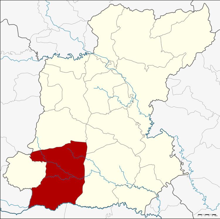 | ||
Kaset Wisai (Thai: เกษตรวิสัย) is a district (amphoe) in southwestern Roi Et Province, Thailand.
Contents
Map of Kaset Wisai District, Roi Et 45150, Thailand
Geography
Neighboring districts are (from the north clockwise) Chaturaphak Phiman, Mueang Suang, Suwannaphum of Roi Et Province, Phayakkhaphum Phisai of Maha Sarakham Province, Pathum Rat of Roi Et Province again and Wapi Pathum of Maha Sarakham Province.
History
Originally named Nong Waeng, it was renamed Kaset Wisai in 1939.
Administration
The district is divided into 13 sub-districts (tambon), which are further subdivided into 175 villages (muban). There are two townships (thesaban tambon): Kaset Wisai and Ku Ka Sing. Each covers parts of the same-named tambon. There are a further 13 tambon administrative organizations (TAO).
References
Kaset Wisai District Wikipedia(Text) CC BY-SA