
Population 474 (2011) | Postcode(s) 4306 Postal code 4306 | |
 | ||
State electorate(s) Electoral district of Ipswich West | ||
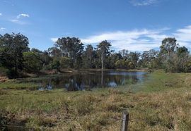
Karrabin is a suburb of Ipswich, Queensland, Australia. At the 2011 Australian Census the suburb recorded a population of 474. The northern boundary is marked by the Warrego Highway.
Contents
Map of Karrabin QLD 4306, Australia
The origin of the suburb name is from the Bundjalung Aboriginal language meaning red gum.
Demographics
In the 2011 Census the population of Karrabin is 474, 48.5% female and 51.5% male. The median/average age of the Karrabin population is 39 years of age, 2 years above the Australian average. 86.9% of people living in Karrabin were born in Australia. The other top responses for country of birth were New Zealand 2.7%, England 2.1%, Germany 0.6%, Fiji 0.6%, Jamaica 0.6%. 96% of people speak English as their first language 0.6% French, 0.6% Mandarin, 0.6% Greek.
Transport
Karrabin Railway Station provides Queensland Rail City network services to Rosewood, Ipswich and Brisbane via Ipswich.