
Population 9,245 (2011 census) Area 6.2 km² | Postcode(s) 4305 Postal code 4305 | |
 | ||
Location 41 km (25 mi) from Brisbane3 km (2 mi) from Ipswich | ||
Brassall is a suburb of Ipswich, Queensland, Australia. In the 2011 census, Brassall had a population of 9,245 people.
Contents
Map of Brassall QLD 4305, Australia
Geography
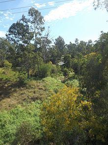
Brassall has a southern boundary partially marked by the Bremer River and a western alignment along Ironpot Creek. The northern boundary follows the Warrego Highway.
History
The suburb name first appears on a plan drawn by surveyor James Warner on 6 October 1851; however, the origin of the suburb name is unknown. It was also known as Hungry Flats, as was a stop over for bullock teams that were transporting logs from Pine Mountain to Hancocks saw mill at North Ipswich. Brassall was a separate shire (Shire of Brassall) with its own council from March 1860 until 1 January 1917 when the area became part of Ipswich. The suburb was officially bounded and named in 1991. The Brisbane Valley railway line once passed through Brassall.
Heritage listings
Brassall has a number of heritage-listed sites, including
Education
The suburb contains three schools: Ipswich State High School, Brassall State School and Ipswich Seventh Day Adventist School.
Since 2003, Brassall has been a key development area in the city of Ipswich. Formerly bushland and farming area leading into the West Moreton district; Brassall has been extensively developed. A new estate named "Grammar Park Estate" opened in Brassall in early 2002. It has since developed significantly with investors subdividing land. A property on Henry street was bought for over $1.5 million and has since been subdivided into over 28 house blocks. Grammar Park Estate now has over 1000 houses. Many families send their children to West Moreton Anglican College, located 5 kilometres (3.1 mi) from Brassall (as the crow flies).
Demographics
At the 2011 Australian Census the suburb recorded a population of 9,245. Brassall is an area of Ipswich which has a higher demographic. As reported in the Australian Bureau of Statistics, Brassall's occupants hold higher levels of education than those from other suburbs. Brassall's occupants vary from retirees, young families and defence personnel.