
Highest elevation 2,460 m (8,070 ft) Time zone WIB (UTC+7) | Lowest elevation 200 m (700 ft) Area 2,127 km² | |
 | ||
Points of interest Sipisopiso, Mount Sibayak, Mikie Funland, Lumbini Natural Park, Mount Sinabung | ||
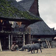
Karo Regency is a regency of North Sumatra, Indonesia, situated in the Barisan Mountains. The regency covers an area of 2,127.25 square kilometres (821.34 sq mi) and according to the 2010 census it had a population of 350,479. 60.99% of the regency is forested. Its regency seat is Kabanjahe. The Batak Karo language is spoken in the regency, as well as the Indonesian language. It borders Southeast Aceh Regency in Aceh to the west, Deli Serdang Regency and Langkat Regency to the north, Dairi Regency and Toba Samosir Regency to the south, and Deli Serdang Regency and Simalungun Regency to the east.
Contents
Map of Karo Regency, North Sumatra, Indonesia
Economy
The GDP per capita of Karo Regency in 2005 was 11.65 million rupiah, approximately US$1,200. 74% of the population work in agriculture, which comprises 60% of regional GDP. The second-largest sector is government, which comprises 11% of the regional GDP.
Administrative divisions
The regency is divided administratively into 17 districts (kecamatan), tabulated below with their 2010 Census population: