
District Ahmednagar Time zone IST (UTC+5:30) Local time Friday 6:57 PM Area code 02488 | PIN 414304 Population 1,031 (2001) | |
 | ||
Weather 25°C, Wind W at 23 km/h, 40% Humidity | ||
Bailgada zumbarsheth vitthal andhale karjule hareshwar final in sakore mp4
Karjule Hareshwar (Marathi: कर्जुले हरेश्वर), formerly called Karjule Harya (Marathi: कर्जुले हर्या)is a village in Ahmednagar district of Maharashtra, India. This village is located on Kalyan Ahmednagar highway National Highway 222. It is located 50 km towards west from District headquarters Ahmednagar. 25 km from Parner. 181 km from State capital Mumbai. It is well known village as Mumbaikar's Village. Most of the family members are working in Mumbai in transportation and many more things.
Contents
- Bailgada zumbarsheth vitthal andhale karjule hareshwar final in sakore mp4
- Map of Karjule Harya Maharashtra
- Education Society
- Schools
- College
- Hareshwar Ratna Awards
- Economy
- Banks
- Financial Societes
- Religion
- Temples
- Mandohol Dam
- Khwajipir Hill
- Pachiambe Lake
- Mothemel Lake
- Roads
- How to Reach
- Geographical Location
- References
Map of Karjule Harya, Maharashtra
Education Society
(Marathi: श्री हरेश्वर शिक्षण प्रसारक मंडळ)
Vishnu Shinde with help of some people from village established an education society named Shree Hareshwar Education Society in 1978. He was president of society since then till 2010. Currently his son Ramdas Shinde is president of the education society. Shivajirao Andhale is current secretory of the society. He has done notable contribution in society's and school's progress.
The society having following schools in Maharashtra State:
The main office of the society is in Karjule Hareshwar.
Schools
Karjule hareshwar has two schools
Provides education from 1st standard to 4th standard
Shree Hareshwar Vidyalaya is one of the best schools in Ahmednagar district. Provides education from 5th standard to 12th standard. Mr. Eknath Date was Head Master of the school for about 28 years. Currently Mr. S.K. Unde is Head master of the school.
College
Rajiv Gandhi College of Engineering.
Approved Running Courses:
Hareshwar Ratna Awards
Hareshwar ratna awards were distributed on 14 April 2014 to those people who have done extraordinary work in their field with ordinary backgrounds, but went on to excel in life. The recipients were 65 in total.
Economy
Majority of the population of Karjule Hareshwar do farming for daily living.
Banks
Financial Societes
Religion
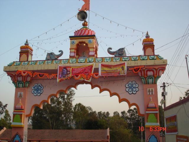
The majority of the population in Karjule Hareshwar is Hindu. But also there are few Muslims. There are several temples and a masque in the village. There is Hareshwar Temple in the village.
Temples
Shree Hareshwar temple is main temple in the village. Karjule Hareshwar is named after this temple.
Mandohol Dam
Mandohol Dam was constructed on Mandohol river between 1977 and 1983. The irrigation was started since 1984. The catchment area of the project is 142.45 km2 (55.00 sq mi). The length of the dam is 510 m (1,670 ft) and the height is 26 m (85 ft). Gross storage capacity of this dam is 11.30 Mcum (399 Mcft). There is a Right Bank Canal, 26 km (16 mi) in length, irrigating an area of 2,266 ha (5,600 acres). It cost around ₹36,200,000 (US$540,000) to complete the project.
Khwajipir Hill
Khwajipir hill is located at east to village.
Pachiambe Lake
The lake is located near Peth.
Mothemel Lake
One more lake neate Pachiambe lake
Roads
Karjule Hareshwar is well connected to other villages by NH 222. MSRTC buses are primary mode of transportation.
How to Reach
Geographical Location
Karjule Hareshwar village is surrounded by hills. On the east it has Takali Dhokeshwar village, on the south it has Karegaon, on the west it has Savargaon while on the north it has Gurewadi village.