
Location Japan | Elevation 644 m | |
 | ||
Topo map Geographical Survey Institute25000:1 狩勝峠25000:1 落合50000:1 夕張岳 Similar Shintoku Station, Ochiai Station, Ikutora Station, Mount Sahoro, Tokachi‑Shimizu Station | ||
A trip to hokkaido torokko rides in shintoku ride the karikachi kogen eco torokko railway
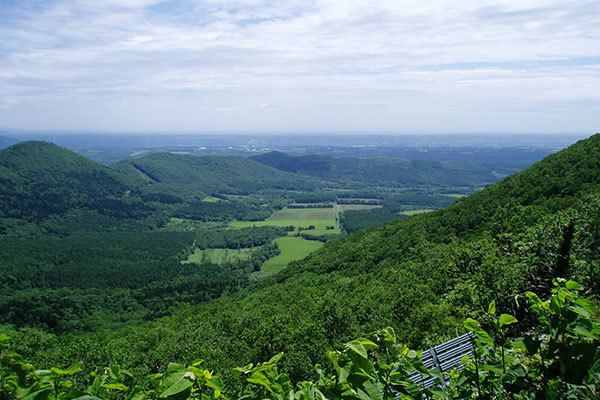
Karikachi Pass (狩勝峠, Karikachi-tōge) is a mountain pass at the north end of the Hidaka Mountains of Hokkaidō, Japan. The pass traverses the mountains at 644 metres (2,113 ft) and is 21 kilometres (13.0 mi) long. The road is 5.5 metres (18.0 ft) wide with a maximum grade of 5.3%. The minimum curve radius is 90 metres (300 ft). Snow is possible on the pass from October to May. Japan National Route 38 crosses the pass between Minamifurano and Shintoku.
Contents
- A trip to hokkaido torokko rides in shintoku ride the karikachi kogen eco torokko railway
- Map of Karikachi toge Shintoku Kamikawa District Hokkaido Prefecture 081 0038 Japan
- References
Map of Karikachi-toge, Shintoku, Kamikawa District, Hokkaido Prefecture 081-0038, Japan
References
Karikachi Pass Wikipedia(Text) CC BY-SA