Samiksha Jaiswal (Editor)

Japan National Route 38

Updated on
Edit
Like
Comment
Share on FacebookTweet on TwitterShare on LinkedInShare on Reddit
Length
  
298.4 km

Japan National Route 38

Highway system
  
National highways of Japan

Major cities
  
Obihiro, Furano, Ashibetsu

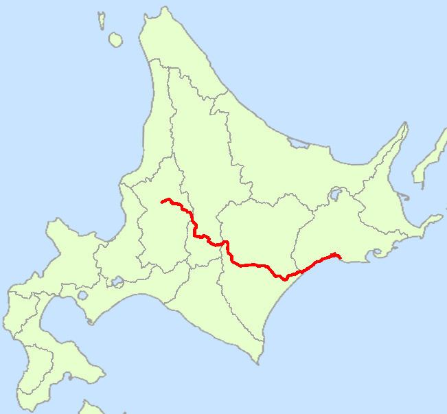
National Route 38 is a national highway connecting Takikawa and Kushiro in Hokkaidō, Japan.

Contents

Map of Japan, Hokkaid%C5%8D, %E5%9B%BD%E9%81%9338%E5%8F%B7%E7%B7%9A

Route Data

  • Length: 298.4 km (185.5 mi)
  • Origin: Takikawa, Hokkaido (originates at junction with Routes 12 and 451)
  • Terminus: Kushiro, Hokkaido (ends at the origin of Route 44)
  • Major cities: Ashibetsu, Furano, Obihiro
  • History

  • 1952-12-04 - First Class National Highway 38 (from Takikawa to Kushiro)
  • 1965-04-01 - General National Highway 38 (from Takikawa to Kushiro)
  • Overlapping sections

  • In Ashibetsu, from North-2 West-1 South intersection to Ashibetsu-bashi intersection: Route 452
  • In Frano, from Wakamatsu-cho 15 intersection to Higashiyama-yanagi intersection: Route 237
  • In Shimizu, South-1-11 to South-4-11: Route 274
  • From Obihiro (Odori North-1 intersection) to Makubetsu (Akeno intersection): Route 242
  • From Urahoro (Yoshino-Kyoei intersection) to the terminus: Route 336
  • From Shiranuka (West-1 South-2 intersection) to Kushiro (Otanoshike intersection): Route 392
  • From Kushiro (Kitaodori-5 intersection) to the terminus :Routes 44, 272 and 391
  • References

    Japan National Route 38 Wikipedia


    Similar Topics