
Elevation 1,302 m (4,272 ft) Last eruption Unknown | ||
 | ||
Similar Kula, Porak, Karaca Dağ, Nemrut, Mount Hasan | ||
Karapınar Field is a volcanic field in central Anatolia, Asian Turkey.
Contents
- Map of KarapC4B1nar Field Ulus Mahallesi 42400 KarapC4B1nar2FKonya Turkey
- Geography
- Features
- References
Map of Karap%C4%B1nar Field, Ulus Mahallesi, 42400 Karap%C4%B1nar%2FKonya, Turkey
Geography
The volcanic area is located near the city of Karapınar, in the Karapınar District of Konya Province.
Features
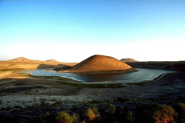
The basaltic Karapınar Volcanic Field consists of five cinder cones, two lava fields, and several explosion craters and maars.
Meke Dağı, at 300 metres (980 ft) in elevation, is one of the largest cinder cones in the Central Anatolia Region.
Meke Dağı is surrounded by Meke Gölü, a crater lake.
References
Karapınar Field Wikipedia(Text) CC BY-SA