
Time zone Sri Lanka (UTC+05:30) Area 1,598 km² ISO 3166 code Sri Lanka | Post Codes 12000-12999 Team Blue Star SC | |
 | ||
DS Division ListAgalawattaBandaragamaBeruwalaBulathsinhalaDodangodaHoranaIngiriyaKalutaraMadurawelaMatugamaMillaniyaPalindanuwaraPanaduraWalallavita Area rank 20th (2.44% of total area) Points of interest Sinharaja Forest Reserve, Kalutara Bodhiya, Brief Garden - by Bevis Ba, Panadura Beach, Richmond Castle Destinations Bentota, Kalutara, Beruwala, Sinharaja Forest Re, Wadduwa | ||
Kalutara District (Sinhalese: කඵතර දිස්ත්රික්කය; Tamil: களுத்துறை மாவட்டம் Kaḷuttuṟai Māvaṭṭam) is one of the 25 districts of Sri Lanka, the second level administrative division of the country. The district is administered by a District Secretariat headed by a District Secretary (previously known as a Government Agent) appointed by the central government of Sri Lanka. The capital of the district is the town of Kalutara.
Contents
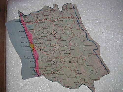
Map of Kalutara, Sri Lanka
Geography
Kalutara District is located in the south west of Sri Lanka and has an area of 1,598 square kilometres (617 sq mi).
Administrative units
Kalutara District is divided into 14 Divisional Secretary's Division (DS Divisions), each headed by a Divisional Secretary (previously known as an Assistant Government Agent). The DS Divisions are further sub-divided into 762 Grama Niladhari Divisions (GN Divisions).
Population
Kalutara District's population was 1,217,260 in 2012. The majority of the population are Sinhalese, with a minority Sri Lankan Moor and Sri Lankan Tamil population.