
Time zone EET (UTC+2) Licence plate 17 Local time Saturday 7:53 AM Area code 0286 | District Yenice Postal code 17560 Elevation 230 m Population 2,238 (2013) Province Çanakkale | |
 | ||
Weather -2°C, Wind S at 3 km/h, 82% Humidity | ||
Kalkım is a belde (town) in Çanakkale Province, Turkey.
Contents
- Map of KalkC4B1m 17560 KalkC4B1m Belediyesi2FYenice2FC387anakkale Turkey
- Geography
- History
- Economy
- References
Map of Kalk%C4%B1m, 17560 Kalk%C4%B1m Belediyesi%2FYenice%2F%C3%87anakkale, Turkey
Geography
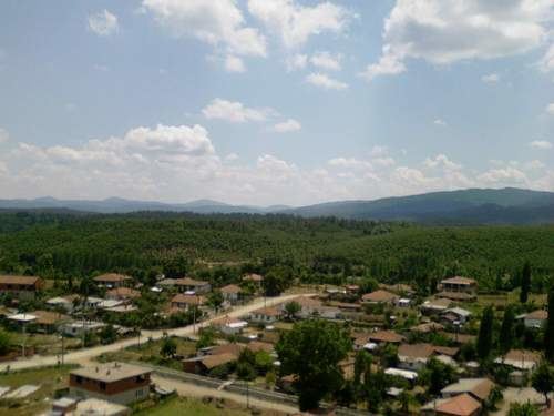
Kalkım is a town in Yenice district of Çanakkale Province. At 39°49′N 27°13′E Kalkım is situated to east of Kalkım pond and to the south of Agonya creek. The distance to Yenice is 38 kilometres (24 mi) and to Çanakkale is 120 kilometres (75 mi). The population of Kalkım was 2238 as of 2013.
History
The area around Kalkım was an important ironworking center during Lydian state and was named as Agonya. During the later years of the ancient age, It was annexed by Achaemenid Empire, Macedonian Empire, Pergamon and Roman Empire. In 1301, it was incorporated into Karesi state (a small Turkmen beylik) After the disantegration of Karesi it became a part of the Ottoman Empire . During Ottoman era it was called Naipli (Naipli is an adjective referring to vice judge working in the settlement). In the 20th century, following a brief Greek occupation it became a part of Turkey in 1922. In 1977 It was declared a seat of township.
Economy
Most important agricultural products of the town are paprika and tobacco. Various fruits are also produced. Some town residents work in lead mines around the town and some work in forestry business. Carpet weaving is another business.