
 | ||
V8 mack superliner kaimai range
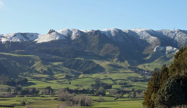
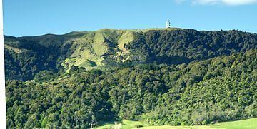
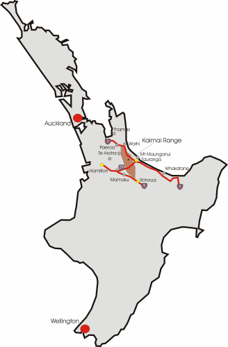
The Kaimai Range (sometimes referred to as the Kaimai Ranges) is a mountain range in the North Island of New Zealand. It is part of a series of ranges, with the Coromandel Range to the north and the Mamaku Ranges to the south. The Kaimai Range separates the Waikato in the west from the Bay of Plenty in the east.
Contents
- V8 mack superliner kaimai range
- Kamai ranges on a luge cart
- Geology
- Kaimai Tunnel
- Flight 441 disaster
- Communications
- References
The highest point of the range is Mount Te Aroha (952 m), at the foot of which is the town of Te Aroha. The range's terrain is rough, and only two roads pass over it: State Highway 2, across the northern end of the range through Karangahake Gorge, and State Highway 29 from Tauranga to Hamilton. Mt Te Aroha can be described as the northern head peak of the Kaimai Range.
The Kaimai Ranges feature in local Maori folklore. The name Te Aroha translates from Maori as Te - The & Aroha - Love. Literally "the love". The name comes from a Maori legend that the sun god - Male, loved the moon goddess - female. They never could see each another due to the planets positions. One day the moon goddess came to earth to see the sun god, knowing the risks, was turned to stone as the daylight came. Hers was the ultimate expression of love. Te Aroha in Maori. This is why on the Kaimai Range, to the right of Mt Te Aroha is a high skyline silhouetted rock that from afar is shaped as a woman. It is known locally as the rock of Hinemoa.
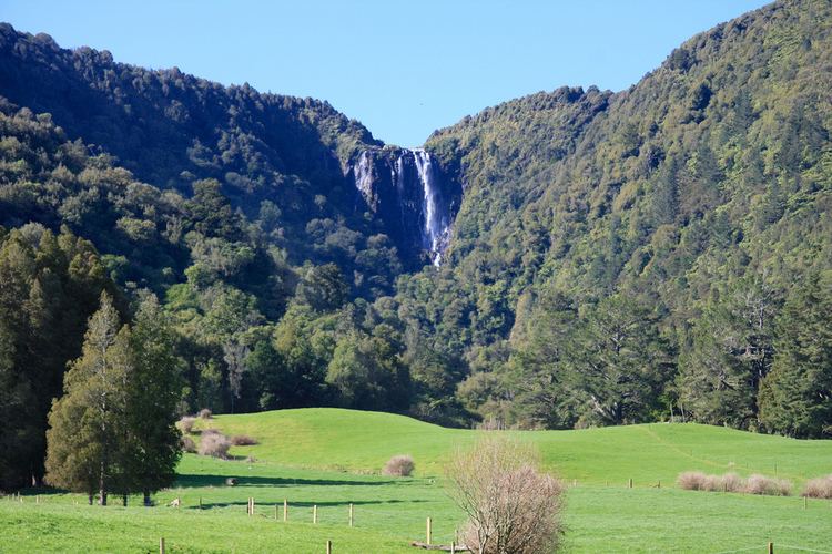
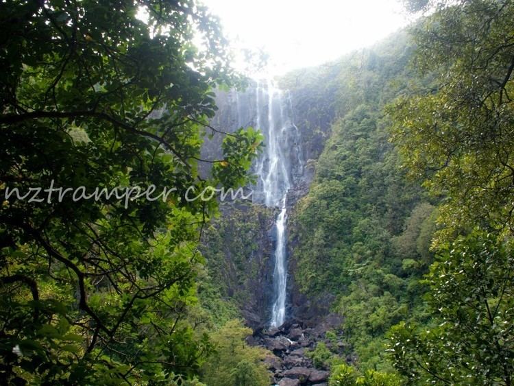
Within the Kaimai Ranges the Hendersons Tramline loop track follows the route of bush tramlines and haul lines once used to extract logs from the bush. The walk includes forest and clearings near the fringe of the park. A side track off the main walk leads down to the base of a waterfall and a large swimming hole. Also some 7 – 10 miles, on the Gordon backroad from te Aroha is a four-wheel drive track named Thomsons track, that takes venturers from the foothills around manawaru to the ranges top, where a large swimming hole is present.
Kamai ranges on a luge cart
Geology
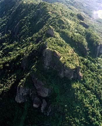
The Kaimai Range is the result of a fault that uplifted primarily andesitic rocks from long-extinct volcanoes. This fault has not been active for about 140,000 years and started more than a million years ago.
Kaimai Tunnel
The Kaimai Railway Tunnel runs for nearly nine kilometres under the range, making it the longest tunnel in New Zealand. Construction of the tunnel started from both sides of the range in 1969: the headings met in 1976 and the tunnel opened on 12 September 1978. The Kaimai Range and this tunnel led to a Silver Fern railcar service between Auckland and Tauranga being named the Kaimai Express. This service operated from 1991 until 2001.
A peak of the Kaimai directly above the tunnel, previously unnamed, was named Stokes Peak in 2010 in honour of geographer Evelyn Stokes.
Flight 441 disaster
At approximately 9:09 am on 3 July 1963 the DC-3 Skyliner ZK-AYZ Hastings operating New Zealand National Airways Corporation Flight 441 from Whenuapai Airport, Auckland to Tauranga crashed into the range. All 23 aboard died, making it the worst air disaster in mainland New Zealand.
Communications
The New Zealand Post Office engineering division (radio) built and maintained a microwave communications facility near the top of Kaimai range, close to the Hamilton–Tauranga highway saddle. In the 1960s it was a Lenkurt relay as part of the national network, linking Sanitorium Hill near Cambridge to Rotorua, with a spur to Tauranga. It now has cell phone and various other radio communications facilities, and is owned and operated by Telecom New Zealand. Land Parcel: Part Section 126 Block II Tapapa SD [1]
Airways New Zealand maintains a Secondary Surveillance Radar installation on Te Weraiti, a peak on the Kaimai range, 5 kilometers north of the State Highway 29 saddle. This is used to facilitate air traffic control of transponder equipped aircraft in the area.