
Country Hong Kong | ||
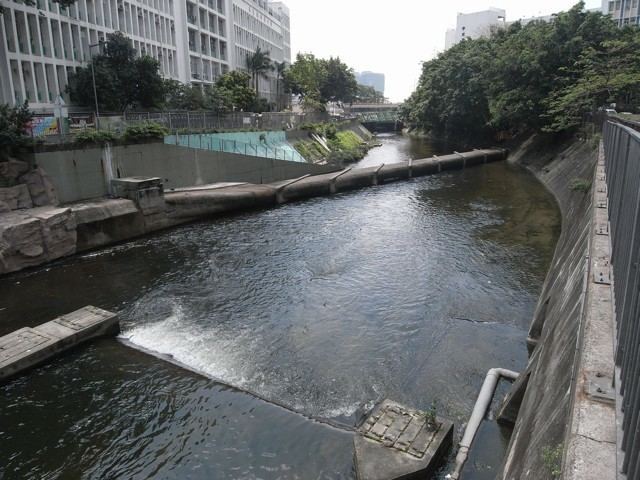 | ||
The Kai Tak Nullah (Chinese: 啟德明渠, also known as the Kaitak River (啟德河)) is a nullah or watercourse that collects water from the rivers and streams flowing from the hills in northern New Kowloon. It empties into a narrow channel leading into the Kwun Tong Typhoon Shelter. Part of the nullah is covered by roads and other facilities.
Contents
Map of Kai Tak River, Hong Kong
The Kai Tak Nullah is about 2.4k in length. It flows from Po Kong Village Road along Choi Hung Road, pass Tung Tau Estate and San Po Kong, into Kai Tak Development Area before discharging into the Victoria Harbour. They have an Upstream and a Midstream. The nullah is one of the major flood relief drainage channels in East Kowloon area. The improvement work of Kai Tak Nullah has been undergoing by Civil Engineering and Development Department since March 2012, aiming to turn the nullah into an attractive green river corridor. It is anticipated to be fully completed before 2021.
History
Originally, the place of Kai Tak Nullah was a bay. During Japanese occupation, Kai Tak Airport was expanded through land reclamation. The extension of Fung Wong Kai Stream was named as Lung Tsun River龍津河.Lung Tsun River's original estuary is at the north of To Kwa Wan Road. But after the airport expansion work, the reclamation for runaway blocked estuary and the river was redirected into today's route.
During New Territories new town development in 1970s, river become a nullah for Tai Po Sewage Treatment Works, The Shatin Sewage Treatment Works and illegal discharge pollutants. This results pollutants and heavy pollutants in water, which also causes smell issue. After the treatment work done by the Drainage Services Department, the Kai Tak Nullah has been significant improvement since 2000. Ardeidae is seen beside the nullah.
Proposal of covering nullahs
On January 2005, Drainage Services Department announced a nullah-covering works for 16 nullahs, which was costed one billion and two hundred million Hong Kong Dollars. It was planned to cover up part of the Kai Tak Nullahs along Choi Hung Road, starting from 2010 and completing by 2014. The Traffic and Transport Committee of Wong Tai Sin District Council demand for acceleration, in order to launch the greening work and widen the Choi Hung Road.
Yet, as the water quality improved, plus the request from political party Democratic Alliance for the Betterment and Progress, Federation of Trade Unions and environment concern group Conservancy Association, the Civil Engineering and Development Department launch the feasibility study on turning nullah into Kai Tak River. They aim to turn it into a new river like the Cheonggyecheon in South Korea.