
Phone number 0237-73-2111 Population 19,303 (Oct 2013) | - Flower Safflower Area 52.38 km² Local time Saturday 2:56 AM | |
 | ||
Weather 0°C, Wind W at 11 km/h, 71% Humidity Points of interest Kahokucho Benihana Museum, Kahoku Children's Zoo, Kahoku Central Park, Yachi Hachiman‑gū Shrine | ||
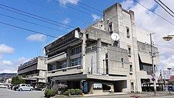
Kahoku (河北町, Kahoku-chō) is a town located in Nishimurayama District, Yamagata Prefecture, Japan.
Contents
- Map of Kahoku Nishimurayama District Yamagata Prefecture Japan
- Geography
- Neighboring municipalities
- Climate
- History
- Economy
- Railway
- Highway
- Twin towns Sister cities
- References
Map of Kahoku, Nishimurayama District, Yamagata Prefecture, Japan
As of October 2013, the town had an estimated population of 19,303 and a population density of 369 persons per km². The total area was 52.38 square kilometres (20 sq mi).
Geography
Kahoku is located in central Yamagata Prefecture, in a river valley of the Mogami River, with branches of the Ōu Mountains to the east and west.
Neighboring municipalities
Climate
Kahoku has a Humid continental climate (Köppen climate classification Dfa) with large seasonal temperature differences, with warm to hot (and often humid) summers and cold (sometimes severely cold) winters. Precipitation is significant throughout the year, but is heaviest from August to October.
History
The area of present-day Kahoku was part of ancient Dewa Province. After the start of the Meiji period, the area became part of Nishimurayama District, Yamagata Prefecture. The modern town of Kahoku was established on April 1, 1954.
Economy
The economy of Kahoku is based on agriculture, notably the growing of cherries. Manufacturing of slippers is also an important local industry.
Railway
Kahoku is not served by any railway lines.