
Palestine grid 171/143 | ||
 | ||
Name meaning The village of the steep or mountain road Weather 13°C, Wind N at 6 km/h, 59% Humidity | ||
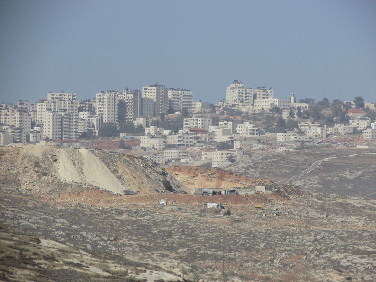
Kafr 'Aqab (Arabic: كفر عقب) is the northernmost Palestinian Arab neighborhood in East Jerusalem. It is located within the municipal boundaries of Jerusalem and two kilometers from Ramallah.
Contents
Map of Kafr 'Aqab
History
The Palestine Exploration Fund's Survey of Western Palestine (SWP) suggested that Kafr 'Aqab was the Crusader village Kefreachab, which was one of 21 villages given by King Godfrey as a fief to the Church of the Holy Sepulchre.
Ottoman era
In 1517, the village was included in the Ottoman empire with the rest of Palestine and in the 1596 tax-records it appeared as Kafr 'Aqba, located in the Nahiya of Jabal Quds of the Liwa of Al-Quds. The population was 47 households, all Muslim. They paid a fixed tax rate of 33,3% on agricultural products, including wheat, barley, olive trees, vineyards, fruit trees, goats and beehives in addition to "occasional revenues"; a total of 3,100 Akçe. In 1838, Edward Robinson noted Kafr 'Aqab during his travels in the region.
An official Ottoman village list sometime around 1870 listed Kefr 'Akab as having 15 houses and a population of 65, though the population count included men, only. In 1883, SWP described it as "a small hamlet on the slope of a hillside, with a few olives."
British Mandate era
In the 1922 census of Palestine conducted by the British Mandate authorities, Kafr 'Aqab had a population of 189 Muslims, increasing in the 1931 census to 250 Muslims, in 59 houses.
In 1945 the population of Kafr 'Aqab consisted of 290 Muslims and the land area was 5,472 dunams, according to an official land and population survey. Of this, 829 dunams were for plantations and irrigable land, 2,736 for cereals, while 10 dunams were built-up areas.
1948-1967
In the wake of the 1948 Arab–Israeli War, and after the 1949 Armistice Agreements, Kafr 'Aqab came under Jordanian occupation.
Post-1967
After the Six-Day War in 1967, Kafr 'Aqab has been under Israeli occupation. According to the Palestinian Central Bureau of Statistics, in 2006, Kafr 'Aqab had a population of 10,411. Primary health care for Kafr 'Aqab is obtained in Al-Ram. In 2007, Kfar 'Aqab was described as a middle class suburb.
While Kafr 'Aqab was annexed with the rest of East Jerusalem by Israel and falls under its full jurisdiction, it is separated from Jerusalem by the Israeli West Bank barrier. Municipal inspectors never inspect the area beyond the barrier. This creates "a planning nightmare and developer's dream".
The al-Faruq mosque in Kafr 'Aqab offers weekly classes in the Islamic teachings of Hizb ut-Tahrir.