
- average 36 m/s (1,271 cu ft/s) Basin area 1,122 km² Source Cherakomban Mala Country India | - location Kerala, India Length 130 km Basin area 1,122 km² Mouth elevation 0 | |
 | ||
Kadalundi river train disaster
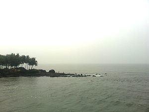
Kadalundi River (Kadalundipuzha) is one of the four most important rivers flowing through Malappuram district in the Indian state of Kerala. The other three are the Chaliyar, the Bharathappuzha and the Tirur River. This rain-fed river is 110 kilometres (68 mi) long and is one of the most important rivers in the district. It is formed by the confluence of the Olipuzha River and the Veliyar River.The Kadalundi originates from the Western Ghats at the western border of the Silent Valley and flows through the district of Malappuram. It has two main tributaries namely Olipuzha and Veliyar. The Kadalundi River drains an area of 1274 km² and has a length of 120 km. The Kadalundi Bird Sanctuary spreads over a cluster of islands where the Kadalundipuzha River flows into the Arabian Sea. There are over a hundred varieties of native birds and around 60 varieties of migratory birds that come here in large numbers annually.