
Elevation 643 m | Time zone EET (UTC+2) | |
 | ||
Kabaw, Kabao or Cabao (Arabic: كاباو) is a town in the Nalut District in northwestern Libya. It lies just 9 kilometres (6 mi) off the Gharyan–Nalut road and about 70 kilometres (43 mi) west of Jadu, on the northern edge of the Tripolitanian Plateau in the Nafusa Mountains.
Contents
Map of Kabaw, Libya
History
Historically, Kabaw was a Berber town in the Ghadames administrative area. After World War II, it was occupied by the French military and governed from Tunisia. It was returned to Libyan control in 1951.
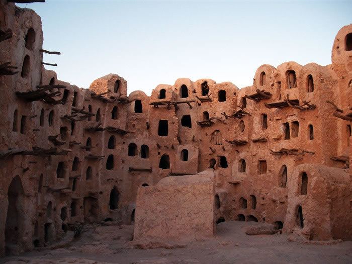
Attractions
Kabaw is home to the ghurfas or "Ksar Kabaw" a Berber hilltop village-fort, now abandoned. The ghurfas is built mainly of rock, gypsum and adobe, with doors made of palm wood.
The Spring Qsar Festival is held in April almost every year.
References
Kabaw Wikipedia(Text) CC BY-SA