
Time zone EAT (UTC+3) Area 1,679 km² | Website www.kabale.go.ug | |
 | ||
One health mission kabale district uganda
Kabale District is a district in the Western Region of Uganda. Kabale hosts the district headquarters. It was originally part of the district of Kabale Kigezi, before the districts of Rukungiri, Kanungu, and Kisoro were excised to form separate districts.
Contents
- One health mission kabale district uganda
- Map of Kabale Uganda
- Location
- Overview
- Population
- Notable people
- References
Map of Kabale, Uganda
Location
The Kabale District is bordered by Rukungiri District to the north, Ntungamo District to the north-east, Rwanda to the east and south, Kisoro District to the west, and Kanungu District to the north-west. Kabale is approximately 420 kilometres (260 mi), by road, south-west of Kampala, the capital of Uganda.
Overview
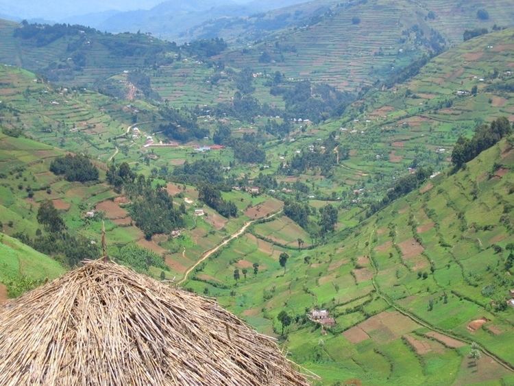
Kabale District is a highland district. The district covers 1,827 square kilometres (705 sq mi). The topography is mainly green, interlocking and heavily cultivated hills with spectacular valleys. The altitude of the district ranges between 1,219 metres (3,999 ft) and 2,347 metres (7,700 ft) above sea level. This altitude makes it colder than the rest of the country. Temperatures average about 18 °C (64 °F) during the day and fall to about 10 °C (50 °F) at night. The relative humidity is between 90% and 100% in the morning and decreases to between 42% and 75% in the afternoon, all the year around. The three counties of Rubanda, Rukiga, and Ndorwa plus the town of Kabale comprise the district.
Population
The 1991 national population census estimated the population of the district at 417,200. The national census in 2012 estimated the population at 458,300. In 2012, the population was estimated at 498,300.
The district is densely populated. With an area of 1,679.1 square kilometres (648.3 sq mi), the population density in 2012 was estimated at 296.7 people per km² ( 768.6 people per mi²). The land is heavily fragmented. An average household has six to seven plots of land on several hills. The people are predominantly from the Bakiga tribe, but also from Batwa (Pygmies), the Banyarwanda and the Bahororo (Toro) tribal clans.