
Length 104.7 km | ||
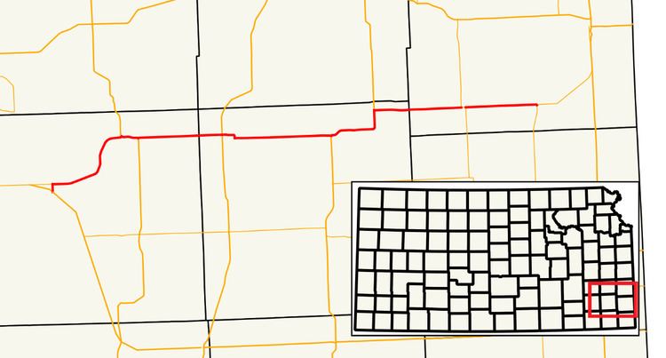 | ||
K-39 is a 65.03-mile-long (104.66 km) state highway in the U.S. state of Kansas. It is an east–west highway, and connects Fort Scott to towns in southeast Kansas.
Contents
Route description
K-39 begins seven miles (11 km) north of Fredonia at U.S. Highway 400 (US-400). It travels east to Benedict, where it turns north toward Buffalo. South of town, K-39 meets US-75 and begins a short, one-mile-long (1.6 km) concurrency with the U.S. Highway. Once leaving US-75, the highway again travels east toward Chanute, where it intersects US-169. The highway continues east 12 miles (19 km) before beginning a seven-mile-long (11 km) concurrency with US-59. After briefly turning north with US-59, K-39 resumes its easterly route north of Stark. The highway shares a very short overlap with K-3 (less than one mile, 1.6 kilometers) and passes through Hiattville before meeting its eastern terminus at K-7, which completes the connection to US-69.
History
K-39 has been at its current alignment since 1999. Prior to that the western terminus was located near Elk City. The portion of the route between Elk City and Fredonia are now county owned roads. Before 1956, when K-39 was modernized, a large portion of the route was unpaved and used 90 degree turns to travel northeast instead of the current diagonal alignment.