
Length 59.88 km | ||
 | ||
Counties | ||
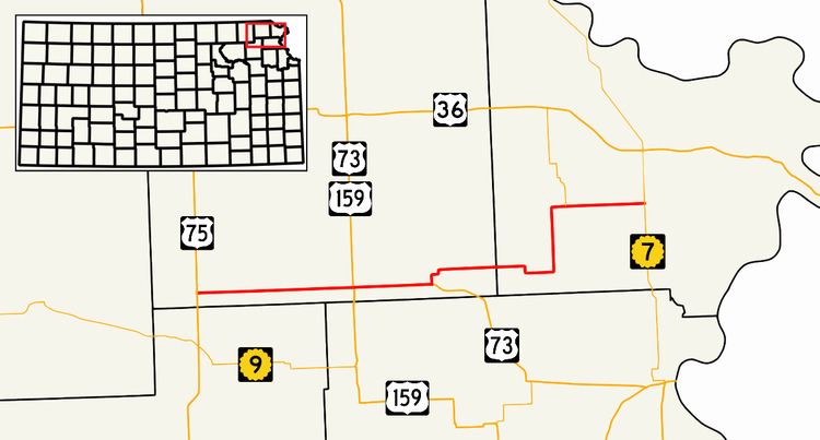
K-20 is a 37.21-mile-long (59.88 km) state highway in the northeastern part of the U.S. state of Kansas. It connects U.S. Route 75 in the Kickapoo Nation Indian Reservation with K-7 southwest of Troy.
Route description
K-20 begins at its western terminus at US-75 in southwest Brown County. It traverses the Kickapoo Nation Indian Reservation for 7 miles (11 km) until reaching Horton, where it begins a 5-mile-long (8.0 km) concurrency with U.S. Route 73 that ends at Everest. From there, K-20 continues east, as US-73 turns southeast, and passes by Purcell and intersects K-137 after crossing into Doniphan County. The route continues east for 5 miles (8.0 km) before turning north towards Denton. At Denton, the route turns east again and passes through Bendena, then terminates at K-7.