
Country United States County Doniphan FIPS code 20-17750 Elevation 328 m Zip code 66017 Population 148 (2013) | Time zone Central (CST) (UTC-6) GNIS feature ID 0484628 Area 36 ha Local time Monday 1:12 PM Area code 785 | |
 | ||
Weather 23°C, Wind S at 50 km/h, 53% Humidity | ||
Denton is a city in Doniphan County, Kansas, United States. As of the 2010 census, the city population was 148. It is part of the St. Joseph, MO–KS Metropolitan Statistical Area.
Contents
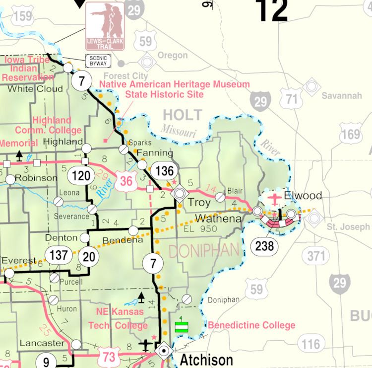
Map of Denton, KS 66017, USA
History
Denton was laid out in 1886. It was named for one of its founders, John Denton.
The first post office at the site of Denton was established in 1882. Prior to 1905, it was called Darwin for some time, then Dentonville.
Geography
Denton is located at 39°43′54″N 95°16′12″W (39.731568, -95.270025). According to the United States Census Bureau, the city has a total area of 0.14 square miles (0.36 km2), all land.
2010 census
As of the census of 2010, there were 148 people, 63 households, and 42 families residing in the city. The population density was 1,057.1 inhabitants per square mile (408.1/km2). There were 74 housing units at an average density of 528.6 per square mile (204.1/km2). The racial makeup of the city was 93.9% White and 6.1% from two or more races. Hispanic or Latino of any race were 2.0% of the population.
There were 63 households of which 36.5% had children under the age of 18 living with them, 50.8% were married couples living together, 9.5% had a female householder with no husband present, 6.3% had a male householder with no wife present, and 33.3% were non-families. 33.3% of all households were made up of individuals and 15.8% had someone living alone who was 65 years of age or older. The average household size was 2.35 and the average family size was 2.95.
The median age in the city was 43.5 years. 20.9% of residents were under the age of 18; 12.2% were between the ages of 18 and 24; 18.3% were from 25 to 44; 36.5% were from 45 to 64; and 12.2% were 65 years of age or older. The gender makeup of the city was 50.0% male and 50.0% female.
2000 census
As of the census of 2000, there were 186 people, 71 households, and 47 families residing in the city. The population density was 1,286.4 people per square mile (513.0/km²). There were 74 housing units at an average density of 511.8 per square mile (204.1/km²). The racial makeup of the city was 99.46% White, and 0.54% from two or more races. Hispanic or Latino of any race were 0.54% of the population.
There were 71 households out of which 38.0% had children under the age of 18 living with them, 62.0% were married couples living together, 2.8% had a female householder with no husband present, and 33.8% were non-families. 32.4% of all households were made up of individuals and 22.5% had someone living alone who was 65 years of age or older. The average household size was 2.62 and the average family size was 3.40.
In the city, the population was spread out with 33.9% under the age of 18, 4.8% from 18 to 24, 29.0% from 25 to 44, 15.1% from 45 to 64, and 17.2% who were 65 years of age or older. The median age was 35 years. For every 100 females there were 95.8 males. For every 100 females age 18 and over, there were 89.2 males.
The median income for a household in the city was $30,500, and the median income for a family was $40,625. Males had a median income of $31,875 versus $20,417 for females. The per capita income for the city was $12,872. None of the families and 4.5% of the population were living below the poverty line, including no under eighteens and 6.9% of those over 64.