
Counties: Geary County Geary County, Kansas | Length 6.222 km | |
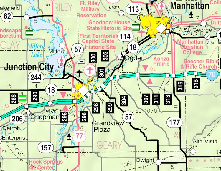 | ||
West end: Rock Springs 4-H Center East end: US-77 between Herington and Junction City | ||
K-157 is a state highway in Geary County, Kansas. It runs from U.S. Route 77 west to the Rock Springs 4-H Center. It has a total length of 3.866 miles (6.222 km).
Contents
Map of K157, 34621 Frielendorf, Germany
It continues east as Skiddy Road W, ending at Skiddy Road just north of Skiddy. A short linking road near the western terminus (old K-157) ends at West Lyons Creek Road (old U.S. 77).
History
K-157 first appeared on the Kansas State Highway Map by 1953, but was less than a mile long. When US 77 was placed on a new alignment to the east of Woodbine, what was K-157 was turned back to local authorities and the current alignment, then a local road, was paved and designated K-157.
Junction list
The entire route is in Geary County.
References
K-157 (Kansas highway) Wikipedia(Text) CC BY-SA