
Time zone CET (UTC+1) Area 45.13 km² Local time Monday 1:09 AM | Postal code 5062 Population 1,609 (2015) Area code 56 | |
 | ||
Weather 7°C, Wind S at 10 km/h, 93% Humidity | ||
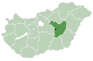
Kőtelek is a village in Jász-Nagykun-Szolnok county, in the Northern Great Plain region of central Hungary.
Contents
Map of K%C5%91telek, Hungary
Geography
It covers an area of 45.13 km2 (17 sq mi) on the right bank of the river Tisza, and has a population of 1609 people (2015).
References
Kőtelek Wikipedia(Text) CC BY-SA