
Car plates OK | Seat Kędzierzyn-Koźle Area 625.3 km² | |
 | ||
Gminas Total 6 (incl. 1 urban)Kędzierzyn-KoźleGmina BierawaGmina CisekGmina PawłowiczkiGmina Polska CerekiewGmina Reńska Wieś Points of interest Kłodnica Canal, Muzeum Towarzystwa Ziemi Koz, Śluza Koźle, Ruiny Zespołu Pałacowego | ||
Kędzierzyn-Koźle County (Polish: powiat kędzierzyńsko-kozielski) is a unit of territorial administration and local government (powiat) in Opole Voivodeship, south-western Poland. It came into being on January 1, 1999, as a result of the Polish local government reforms passed in 1998. Its administrative seat and only town is Kędzierzyn-Koźle, which lies 40 kilometres (25 mi) south-east of the regional capital Opole.
Contents
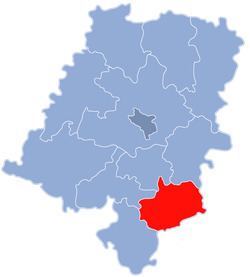
Map of K%C4%99dzierzyn-Ko%C5%BAle County, Poland
The county covers an area of 625.28 square kilometres (241.4 sq mi). As of 2006 its total population is 102,118, out of which the population of Kędzierzyn-Koźle is 65,572 and the rural population is 36,546.
Neighbouring counties
Kędzierzyn-Koźle County is bordered by Strzelce County to the north, Gliwice County to the east, Racibórz County to the south, Głubczyce County and Prudnik County to the west, and Krapkowice County to the north-west.
Administrative division
The county is subdivided into six gminas (one urban and five rural). These are listed in the following table, in descending order of population.