
District Bautzen Time zone CET/CEST (UTC+1/+2) Area 47.04 km² Local time Sunday 9:06 PM Dialling code 035931 | Elevation 141 m (463 ft) Postal codes 02699 Population 3,864 (31 Dec 2008) Postal code 02699 | |
 | ||
Weather 10°C, Wind W at 13 km/h, 94% Humidity | ||
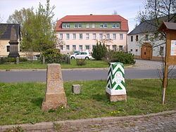
Königswartha, in Sorbian Rakecy, is a municipality in the east of Saxony, Germany. It belongs to the district of Bautzen and lies 20 km north of the eponymous city.
Contents
Map of K%C3%B6nigswartha, Germany
The municipality is part of the recognized Sorbian settlement area in Saxony. Upper Sorbian has an official status next to German, all villages bear names in both languages.
"Rakecy" means "men of the cancer". The village was mentioned the first time in 1350.
Geography
The municipality is situated in the Upper Lusatian flatland. The village stretches along the river Schwarzwasser.
Villages
Several villages belong to the municipality:
References
Königswartha Wikipedia(Text) CC BY-SA