
Prominence 605 m (1,985 ft) Easiest route Hiking | Elevation 1,487 m | |
 | ||
Similar Calvitero, Pico del Lobo, Aitxuri, La Villuerca, Las Banderillas | ||
Navidad ja lama 2016
The Jálama is a 1,487-metre (4,879 ft) mountain in western Spain.
Contents
- Navidad ja lama 2016
- Map of Pico JC3A1lama 10892 CC3A1ceres Spain
- Etwinning ies ja lama
- EtymologyEdit
- GeographyEdit
- Access to the summitEdit
- References
Map of Pico J%C3%A1lama, 10892, C%C3%A1ceres, Spain
Etwinning ies ja lama
EtymologyEdit
In the local language of the NE corner of Cáceres province the mountain is known as Xálima. Both names probably come from Paleohispanic languages. The Jálama valley is home to a Galician-like language known as Fala.
GeographyEdit
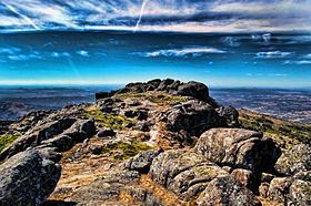
The mountain is located on the border between the provinces of Cáceres (autonomous community of Extremadura) and Salamanca (Castile and León). It's one of the highest peaks of the mountain range called Serra de Xálima. Its summit offers a good view on Salamanca's upland.
Around 3 km NE from the summit, the Arroyo de la Cervigona waters create a 60 m waterfall, the highest in the area.
Access to the summitEdit
The summit can be accessed from Acebo, through the Mirador de La Ventosa (794 m) and the mountain pass of Puerto de Perales.