
Length 1,240 km | Source elevation 600 m | |
 | ||
- location Amazonas–Mato Grosso border, Brazil | ||
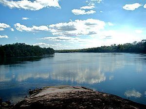
The Juruena River (Portuguese: Rio Juruena) is a 1,240 km (770 mi) long river in west-central Brazil, in the state of Mato Grosso.
Contents
Map of Juruena River, Brazil
Course
The Juruena originates in the Parecis plateau. Within Mato Grosso the river defines the eastern boundary of the 227,817 hectares (562,950 acres) Igarapés do Juruena State Park, created in 2002. For the last 190 km (120 mi) of its lower part the river becomes the border between the states Mato Grosso and Amazonas. In this section the river forms the boundary between the Sucunduri State Park to the west in Amazonas and the Juruena National Park to the east in Mato Grosso. In the north of this section it forms the boundary between the Bararati Sustainable Development Reserve in Amazonas and the Apiacás Ecological Reserve in Mato Grosso.
The Juruena finally joins the Teles Pires river to form the Tapajós river, which is one of the biggest tributaries to the Amazon River. The Juruena River is not navigable due to its many waterfalls and rapids. The river is known for the Salto Augusto Falls.