
Population 15,687 Post town JOHNSTONE Local time Monday 6:25 AM | OS grid reference NS434628 Sovereign state United Kingdom Postcode district PA5 Dialling code 01505 | |
 | ||
Weather 7°C, Wind SW at 23 km/h, 93% Humidity UK parliament constituency | ||
Johnstone pipe band bathgate scotland
Johnstone (Scots: Johnstoun, Scottish Gaelic: Baile Iain) is a town in the council area of Renfrewshire and larger historic county of the same name in the west central Lowlands of Scotland.
Contents
- Johnstone pipe band bathgate scotland
- Map of Johnstone UK
- History
- Education
- Air
- Road
- Bus Services
- Rail
- Notable inhabitants
- References
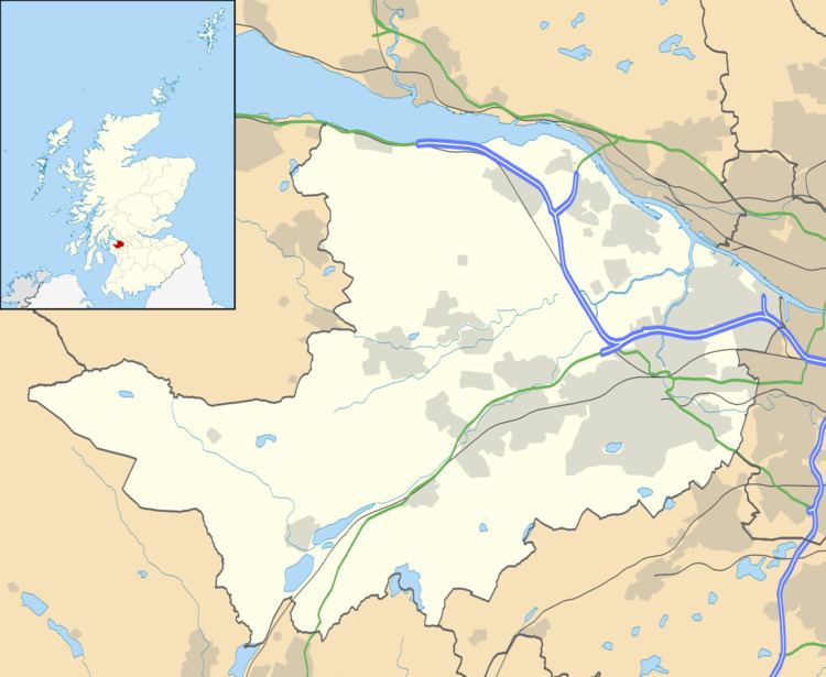
Map of Johnstone, UK
The town lies 3 miles (5 km) west of neighbouring Paisley and 12 miles (19 km) west of the centre of the city of Glasgow and 12 miles (19 km) north east of Kilwinning. Part of the biggest conurbation in Scotland, Johnstone is at the western edge of the Greater Glasgow Urban Area.
History
Johnstone was largely a planned community which grew up around the house of Easter Cochrane, later known as Johnstone Castle, seat of the Houston or Houstoun family who gained their name from the nearby village of Houston. In 1782, the Laird, George Houstoun, commissioned designs for a series of regular residential streets which now form the town centre. At this early stage of development, the town’s population including the local estate and rural hinterland was around 1,500. Two mirroring civic squares were also constructed in the town: Houstoun Square and Ludovic Square, and by 1794 the town had gained its current parish church. Johnstone was raised to the status of a police burgh with significant local powers, a status which is now defunct.
Industrial development brought both prosperity and poverty to the community. Coal mining occurred in Johnstone, although its main industry was related to the thread and cotton industries, with mills powered by the Black Cart Water which runs to the north of Johnstone. As the community expanded, slum conditions formed in part of the town: the population by 1831 had increased to a sizeable 5,600. This was addressed in the 1930s by a significant expansion of the size of Johnstone to include a number of purpose-built residential estates.
Much of Johnstone’s feudal heritage has disappeared. With the death of the last Laird in 1931, Johnstone Castle found some other uses before falling into disrepair and being largely demolished.
Education
Thorn Public School, as it was originally called, opened in 1904 on a site that is now occupied by a housing estate, Thornhill Gardens and was demolished in 1990 and a new Thorn Primary School opened in 1988.
In 1950 St. David's Primary School was built along with its sister school Cochrane Castle Primary School. In 2007 the two schools were housed in a new shared building just outside Thomas Shanks Public Park. Embedded within Cochrane Castle is the Cochrane Castle Golf Club, which once held the world record for the longest hole.
Johnstone High School opened on its present site in March 1965, the previous building having burnt down in 1960. Where the old school stood in Ludovic Square there is now a modern health centre. The original St Cuthberts High School was built adjacent to Johnstone High School and shared the same driveway and car parks. The school closed in 1972 and moved to a new site in Hallhill Road Spateston that year. The original school was demolished and replaced by a housing development to the left of the driveway of Johnstone High School. In 1967, St. Cuthbert's High School was built and established. The school closed at the end of the summer term 2006 along with St. Brendan's High School in Linwood due to falling rolls and the buildings' poor state of repair. These were replaced by a new build St. Benedict's High School named in honour of St Benedict of Nursia the patron saint of Europe and of students. The old St. Cuthbert's building was used to house several schools (including Johnstone High School) while their own premises are being refurbished, but the building has now been demolished.
Air
Johnstone is served by Glasgow International Airport, which is located 3 1⁄2 miles (5.6 km) northeast of the town. Moreover, Prestwick International Airport is a 30-to-40-minute train journey from Johnstone railway station.
Road
A dual carriageway, the A737 connects Johnstone to the M8 motorway to provide car transport links to central Scotland.
Bus Services
McGill's Bus Service Limited operate the majority of local services from their depot in the west end of Johnstone.
Key Coaches are a local service operator based in Elderslie.
Other services are provided by many other operators. They are as follows:
Rail
Johnstone is linked to Glasgow Central, Paisley and the Ayrshire coast by the Johnstone railway station which is located at the east of the town on Thorn Brae. A second unmanned station Milliken Park railway station lies at the west end of the town, just off the Cochranemill road. The railway line runs through the cutting of the old Glasgow–Ardrossan canal, although the route of the canal runs under the original bridge, Dick's Bridge, at the bottom of the Thorn Brae, where the canal basin was situated and in winter, the rim of the canal basin sometimes becomes visible.
It may be noted that a second railway line ran through the town serving the villages of Kilbarchan, Bridge of Weir, and Kilmacolm; the line now forms part of the Clyde to Forth cycle route (National Cycle Route 75). It had a station serving the Northern, more industrial areas of town, Johnstone North railway station.