
Existed: 1917 – present Length 193.1 km | Constructed 1917 | |
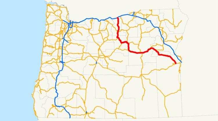 | ||
John Day Highway No. 5 is a highway in eastern Oregon. It comprises Oregon Route 19, and portions of Oregon Route 207 and U.S. Route 26.
Contents
Map of John Day Hwy, Oregon, USA
Route description
The western terminus of John Day Highway is at an intersection with Interstate 84, 1 mile (1.6 km) north of Arlington. It follows OR 19 southward for about 76 miles (122 km), through the cities of Condon and Fossil, where it meets with OR 207 at Service Creek. Here John Day Highway turns eastward and follows OR 207 for 16 miles (26 km) to Spray. At Spray, John Day Highway splits from OR 207 and goes southward. It passes the community of Kimberly, through the John Day Fossil Beds National Monument, and meets up with U.S. 26. The highway then follows US 26 eastward, through the communities of Dayville, Mount Vernon, Prairie City, Unity, Ironside, and Jamieson. The eastern terminus of John Day Highway is at Vale.
John Day Highway from Fossil to Austin Junction is also a part of the Journey Through Time Scenic Byway, an Oregon state byway.