
Elevation 3,200 m Local time Sunday 2:38 AM | Time zone IST (UTC+5:30) Population 332 (2001) | |
 | ||
Weather -16°C, Wind S at 3 km/h, 70% Humidity | ||
Our himalayan journey delhi manali jispa pang leh nubra pangong sarchu delhi
Jispa (elevation 3,200 m or 10,500 ft; population 332) is a village in Lahaul, in the Indian state of Himachal Pradesh.
Contents
- Our himalayan journey delhi manali jispa pang leh nubra pangong sarchu delhi
- Map of Jispa Himachal Pradesh 175132
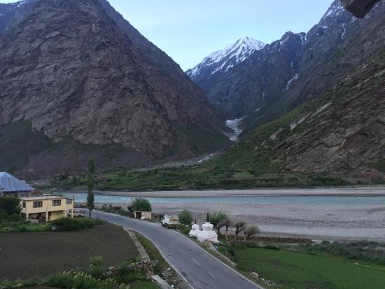
- Bhaga river flowing beside jispa monastery serene beauty of this place is amazing
- References
Map of Jispa, Himachal Pradesh 175132
Jispa is located 20 km north of Keylong and 7 km south of Darcha, along the Manali-Leh Highway and the Bhaga river. There are approximately 20 villages between Jispa and Keylong.
According to the 2001 census, of the town's 332 residents, 235 were male and 97 were female. Four belong to scheduled castes, and 149 belong to scheduled tribes. The village has 78 households.
The village has a helipad, a post office, and a monastery. Travellers often stop for the night here; the village has a hotel, a mountaineers' hut, and a campground. Jispa also has a small folk museum.
Bhaga river flowing beside jispa monastery serene beauty of this place is amazing
References
Jispa Wikipedia(Text) CC BY-SA