
Founded by British rule Elevation 131 m Area code 05114 | Time zone IST (UTC+5:30) Local time Saturday 6:27 PM | |
 | ||
Weather 22°C, Wind N at 6 km/h, 63% Humidity | ||
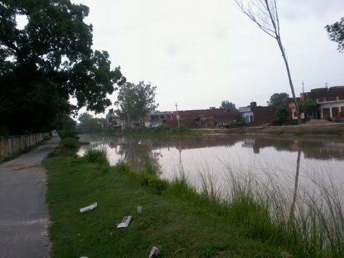
Jhinjhak (झींझक) is a town and a Nagar Palika Parishad in Kanpur Dehat District in the Indian state of Uttar Pradesh. The town is situated on the banks of the Lower Ram Ganga canal.
Contents
- Map of Jhinjhak Uttar Pradesh 209302
- History
- Transport
- Schools and colleges
- Devotional places
- Demographics
- References
Map of Jhinjhak, Uttar Pradesh 209302
History
Jhinjhak Nagar Panchayat was created on 11 January 1916 in British Government. In the Year 1972 its boundaries expanded and included nearby villages "Turana" and "tikan Gaon" . In the Year 2016 Jhinjhak became the Nagar Palika Parishad and its area also expanded including some more Near by villages.
Transport
The major town Jhinjhak is a Railway Station on (NCR)/North Central Railway line. Nearest station to east is Rura at a distance 19 km and Kanpur is at 63 km.In the west nearest station is Phaphund and Etawah .It is also connected to Kanpur by roads via Rura and Kalyanpur.Nearest Airport in Kanpur.
Schools and colleges
Schools:
Degree Colleges:
Devotional places
Demographics
As per the census 2011 Jhinjhak had a population of 24,027. Males constitute 52.64% of the population and females 47.36% with a sex ratio of 899 female/1000 males. The Schedule Caste (SC) population within the Jhinjhak Nagar Panchyat is 18.57% of the total population with a sex ratio of 896 female/1000 males. Schedule Tribe (ST) population in the area is 0.054% out of a sex ratio of 625 female/ 1000 male. The total number of literate within the study area is 17874 which are 74.39% of total population. Male literacy rate of the study area is 55.99% and female literacy rate is 44.01%.