Neha Patil (Editor)

Jesús de Machaca Municipality

Updated on
Edit
Like
Comment
Share on FacebookTweet on TwitterShare on LinkedInShare on Reddit
Country
  
Bolivia

Seat
  
Jesús de Machaca

Population
  
13,247 (2001)

Department
  
La Paz Department

Area
  
955 km²

Province
  
Ingavi Province

Jesús de Machaca Municipality

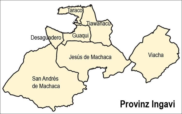
Jesús de Machaca Municipality is the sixth municipal section of the Ingavi Province in the La Paz Department in Bolivia. It was created by Law No. 2351 on May 7, 2002, during the presidency of Jorge Quiroga Ramírez. Its seat is Jesús de Machaca.

Contents

Geography

Jesús de Machaca lies south of Lake Titicaca. The Chilla-Kimsa Chata mountain range traverses the municipality. Some of the highest mountains of the municipality are listed below:

Division

The municipality consists of the following ten cantons:

  • Aguallamaya - 1,694 inhabitants (2001)
  • Chama - 1,278 inhabitants
  • Cuipa España de Machaca - 662 inhabitants
  • Jesús de Machaca - 862 inhabitants
  • Kalla Tupac Katari - 2,669 inhabitants
  • Khonkho San Salvador - 755 inhabitants
  • Mejillones de Machaca - 845 inhabitants
  • Santa Ana de Machaca - 363 inhabitants
  • Santo Domingo de Machaca - 588 inhabitants
  • Villa Asunción de Machaca - 3,244 inhabitants
  • The people

    The people are predominantly indigenous citizens of Aymara descent.

    Places of interest

    Some of the tourist attractions of the municipality are:

  • The archaeological site of Qhunqhu Wankani in Jesús de Machaca Canton
  • Jesús de Machaca, an indigenous community
  • Yakayuni saltflats in Jesús de Machaca Canton where salt exploitation is possible
  • Uru Iruito community in Jesús de Machaca Canton and the Urus Iruito museum in Jesús de Machaca
  • References

    Jesús de Machaca Municipality Wikipedia


    Similar Topics