
Use Hiking Length 422,000 m | Trail difficulty Easy to Moderate | |
 | ||
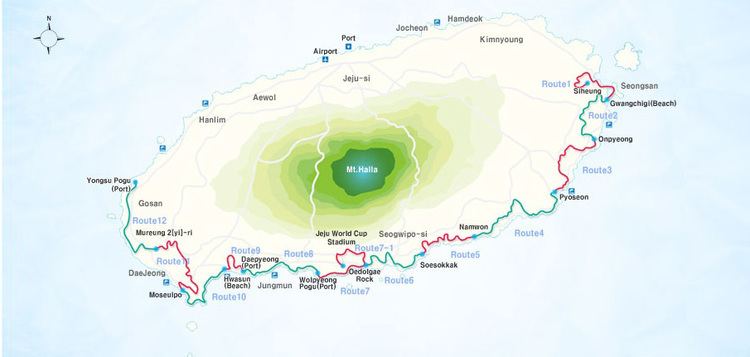
Trailheads Route 1: Shiung-riRoute 21: Jongdali Season All (heat advisory for July and August) Months All (particularly April, May, September, October) | ||
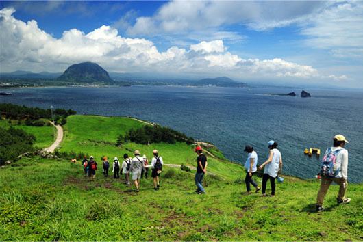
The great jeju olle trail adventure get qiranger out there 6 gopro korea
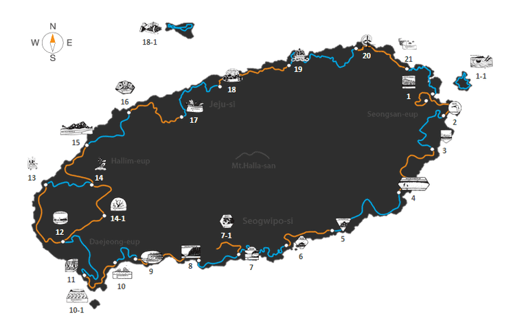
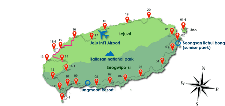
Jeju Olle Trail is a long-distance foot path on Jeju Island, an island off the south-west coast of South Korea. The overall route, mostly following the coastline, consists of 21 connected numbered main routes, 5 sub-routes, and a short spur that connects to Jeju International Airport. The routes have an average length of 16 km and all together total 422 km. The exact length and locations change over time as trails are modified or re-routed.
Contents
- The great jeju olle trail adventure get qiranger out there 6 gopro korea
- Jeju olle trail visite guid e de l le en vid o tourisme en cor e
- Opening Jeju Olle Trail
- Route 1
- Route 1 1
- Route 2
- Route 3
- Route 4
- Route 5
- Route 6
- Route 7
- Route 8
- Route 9
- Route 10
- Route 11
- Route 12
- Route signs
- The ripple effect of Ollegil
- Friendship Trails
- International Awards
- World Trails Conference
- World Trails Network
- References
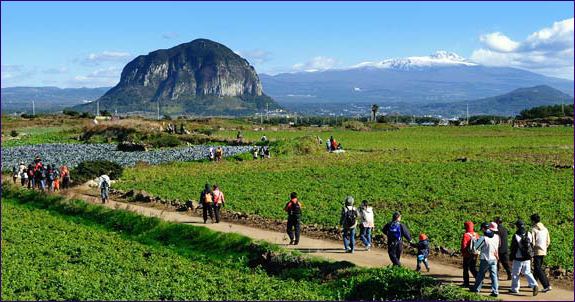
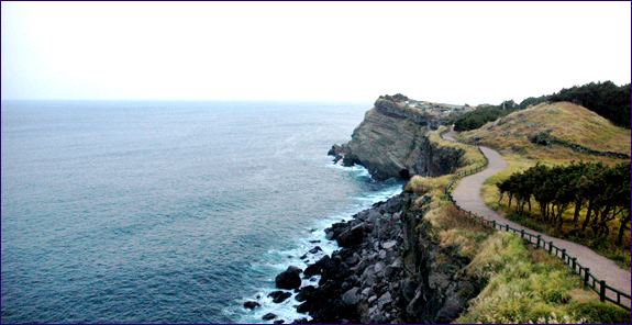
The routes pass through various landscapes along the way including small villages, beaches, farms, and forests. Many routes encompass some of the island's 368 oreums, which are low parasitic volcanoes and historical sites dating from ancient times through to the modern era.
Since its founding in 2007, it has become a major draw for Jeju Island, which attracts not only visitors from mainland South Korea, but also international travelers who have a taste for hiking. According to a 2008 statistic, over 1.2 million people visited and brought $25 billion in economic benefits to South Korea.
Jeju Olle Trail derives its name from Olle, which is the local Jeju dialect word for "a narrow pathway that is connected from the street to the front gate of a house". Gil means "road or pathway" in standard Korean.
The trail can be walked in either direction by following the appropriately colored route signs.
Jeju olle trail visite guid e de l le en vid o tourisme en cor e
Opening Jeju Olle Trail
Jeju Olle Trail was founded by ex-journalist Suh Myung-suk, who worked for Sisa Journal and the original citizen journalism web site, Oh My News. Exhausted after strenuous years working as a journalist, she felt a need to refuel herself. As a way to do this, she walked the Camino de Santiago in Spain. Suh Myung-suk was highly impressed and inspired by the trip, so she decided to create a similar hiking trail on her home island of Jeju. After organizing a team for her goal, she started the time-consuming project of discovering and creating hike-able routes on the island. Suh opened her first trail to the public in September 2007.
Route 1
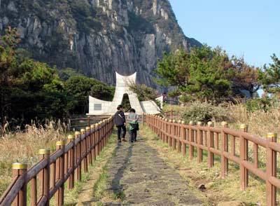
Route 1 opened to the public in September 2007 and is seen a good introduction route for Jeju Olle Trail as a whole. Three of the island's oreums, including the UNESCO World Heritage Site Seongsan Ilchulbong, are visited. There are also fields, quiet villages, coastal roads, and beaches to wander through. The route is considered "medium" difficulty and goes for 15km. A typical hike lasts 4 to 5 hours. The Information Center has moved ten minutes into the trail after starting from the stone route marker.
Route 1-1
This sub-route requires a 15-minute ferry ride from Seongsan Port to the island of Udo. Hikers pass one of the few coral beaches in South Korea and many small fields. Route 1-1 is considered "easy" with a distance of 11.3km over 4 to 5 hours. Hikers should note of the one oreum climb towards the end and a lack of tree cover in the summer months.
Route 2
Visitors can enjoy Jeju Island's eastern coastline as they walk by. They can also take a look at Honinji, a wedding pond with a special myth attached to it.
Route 3
At the Tong Oreum and Dokjabong, visitors can experience both the beautiful scenery and the volcanic hills of Jeju Island. Along the route, there is a Kim, Young-gab Gallery, which visitors may find enjoyable.
Route 4
Walkers can see traditional women divers called "Haenyo" during their hike. They can also enjoy the path in Ganungae, which has recently been restored after 35 years. Mang Oreum and Gusun Saemi also provide beautiful scenery.
Route 5
Seongsan Ilchulbong can be seen clearly from this path, and visitors can enjoy the sea atmosphere as they walk.
Route 6
Visitors are led to the streets of Seogwipo city, where they can experience the local life as well as visit the famous Korean painter Lee, Joong-seop's residence. Beginning hikers tend to find this course easier than other routes.
Route 7
As a seaside walking trail, walkers can enjoy the beautiful coastline of the island. Along the Subong-ro, hikers can enjoy in the midst of pampas grass and wild flowers.
Route 8
Only divers in Jeju Island used to use this trail. Visitors to Jusangjoelli can see stone pillars from the eruption of Mt. Halla.
Route 9
This course is distinctive in the sense that its road passes through valleys. For instance, hikers walk through Andeok Valley, a forested valley.
Route 10
When hikers reach the peak of Mt. Songak, they can see Marado, the southernmost island of Korea. Visitors can also see Mt. Sanbag, the mountain that formed Jeju Island with its eruption.
Route 11
On this route, visitors can experience the history of Korea and Jeju Island at Alturu Airfield, Udal Oreum, and sacred ground of Jung.
Route 12
Route 12 takes in both the interior countryside and protected volcanic coastline of Jeju. The route begins at an old island elementary school, which closed due to lack of students. It is now an ecological school group retreat. Farmers fields feature heavily followed by the first of three oreum climbs. Nongnam Bong is a leafy exersion with views over the south-western tip of Jeju. After this hikers descend into some of the flattest agricultural land on the island. Among the crops the hike continues until Suweolbong, which is also a Geopark. Here Chagwido sits out in the ocean. Until the 1970s a number of families lived there. The hike goes along the coast, up and down Dang Oreum, before finishing at Yong-su Port, with its Catholic connections.
Route signs
Suh Myung-suk had a clear principle when she worked on the route signs for Jeju Olle Trail. She would use eco-friendly materials and make any signs go along with nature, but be easily seen.
She was inspired by the route signs she saw in Santiago. The signs were made up of shells or rocks, and only yellow arrows were painted on them. Similarly, but distinctively she decided to lacquer blue arrows on rocks as blue was the color that hikers on Jeju Olle Trail could always see in the skies and seas of the island. For the routes on which she could not find rocks, she tied blue ribbons on nearby trees. However, she soon found it necessary to slightly alter her original plan. Spraying lacquer could damage rocks and as a consequence that conflicted with her conviction to not harm nature. Instead of lacquering the arrows with blue Suh chose to paint the arrows. Routes signs have gone on to expand to blue and orange ribbons along with the Ganse outline, which is shaped after the distinctive Jeju pony. These blue outlines indicate how long a hiker has left is on the particular route. Wooden arrows are also placed a crossroads, while plates are tied to utility poles in the city and some trees in the forest. There are detour and danger signs at locations that require caution. A map and de-tour distance, if needed, are shown. The start of every route has a marker stone. There is a wooden Ganse box with stamps for an Jeju Olle Trail passport to record progress.
The blue arrows represent the originally intended hiking direction while the orange arrows offer the alternative.
The ripple effect of Ollegil
The popularity and support people gave to Ollegil has influenced other South Korean regional districts to model Ollegil and come up with their own regional variation of it: Dullegil of Jirisan, Jigetgil of South Sea, and Yetgil of Mudeungsan. The local government of Chungcheongnam-do also has plans to expand its trails and build walking routes modeled after Ollegil ("Solbaramgil") in its 16 counties.
Friendship Trails
Five friendship trails have so far been announced between Jeju Olle Trail and other hiking trails around the world. The first was with Switzerland's Lavaux Vineyard Trail in August 2010. Further agreements have been reached with the UK's Cotswolds Way, and the Hockley Valley section of the Bruce Trail in Canada.
International Awards
Jeju Olle Trail won the inaugural International Award at the 21st International Trails Symposium in 2013 for working diligently to develop trails since its founding in 2007.
World Trails Conference
Jeju Olle Trail has hosted the International Trails Conference every year since its inception in 2010 and attracts trail experts from all over the world.
World Trails Network
The Jeju Olle Foundation has also helped create the World Trails Network which hopes to share the current issues and common values of trails in the world and establish the trail industry towards sustainable development.