
Population 574 (2011) Sovereign state United Kingdom Local time Friday 7:54 PM Post town Kilgetty | OS grid reference SN089066 Country Wales Postcode district SA68 | |
 | ||
Weather 9°C, Wind S at 14 km/h, 92% Humidity UK parliament constituency Carmarthen West and South Pembrokeshire | ||
Jeffreyston pram push 2011
Jeffreyston (also known as Jeffreston) is a village, parish and community in Pembrokeshire.
Contents
Map of Jeffreyston, Kilgetty, UK
Jeffreyston lies on the B4586 road about one mile west from the main A477 road; the nearest town is Tenby about six miles (9.7 km) to the south and east. As well as Jeffreyston itself, the community includes the settlements of Cresselly, Cresswell Quay, Loveston, Broadmoor and Yerbeston.
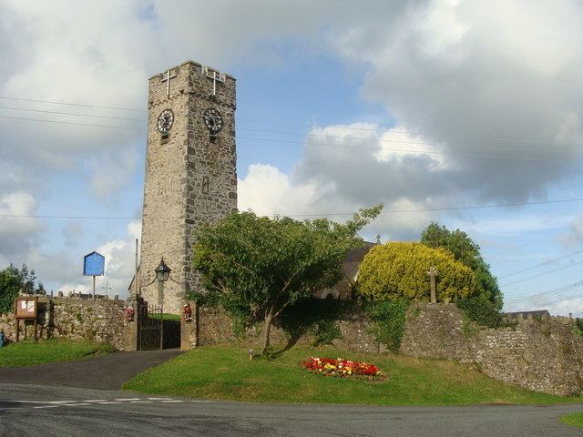
The parish church is dedicated to St Jeffrey and St Oswald and is a grade II* listed building.
Cresselly House in the village of Cresselly is a Georgian country house, seat of the Allen family, which is now a country house hotel and wedding venue. Castle School Pembrokeshire is also in Cresselly.
References
Jeffreyston Wikipedia(Text) CC BY-SA