
Area code(s) 515 Elevation 325 m Population 4,257 (2013) | Time zone Central (CST) (UTC-6) FIPS code 19-39450 Zip code 50129 Local time Friday 1:25 PM | |
 | ||
Weather -4°C, Wind N at 14 km/h, 28% Humidity | ||
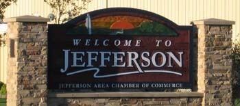
Jefferson is a city in Greene County, Iowa, United States, along the North Raccoon River. The population was 4,345 at the 2010 census. It is the county seat of Greene County. It is the home of the Mahanay Memorial Bell Tower, 168 feet (51 m) tall, located on the town square, and visible for miles. The tower is named for Floyd Mahanay, a businessman, philanthropist, and former resident. Jefferson is bisected east to west by the old Lincoln Highway (formerly U.S. 30). A new U.S. 30 is located about one mile to the north.
Contents
- Map of Jefferson IA 50129 USA
- History
- Geography
- 2010 census
- 2000 census
- Mahanay Memorial Bell Tower
- Festivals
- Notable people
- References
Map of Jefferson, IA 50129, USA
History
While platted and settled a few years earlier, "New Jefferson" was organized in the winter of 1855–56 and officially incorporated in January 1872. It began as a farming community and remains so today. The first settlers of the new city were the family of George S. Walton who built there in 1855. During the Civil War, Jefferson as well as Greene County contributed its sons to raising Company H, 10th Iowa Infantry (1861) and Company E, 39th Iowa Infantry (1862). The railway came to Jefferson in the decades after the Civil War. Jefferson's first mayor was Mahlon Head, elected in 1872. Jefferson's library was completed in 1904 through the generosity of the Carnegie library fund. The stretch of Lincoln Highway that runs through Jefferson was completed circa 1924.
Geography
According to the United States Census Bureau, the city has a total area of 6.01 square miles (15.57 km2), of which, 5.97 square miles (15.46 km2) is land and 0.04 square miles (0.10 km2) is water.
2010 census
As of the census of 2010, there were 4,345 people, 1,900 households, and 1,172 families residing in the city. The population density was 727.8 inhabitants per square mile (281.0/km2). There were 2,156 housing units at an average density of 361.1 per square mile (139.4/km2). The racial makeup of the city was 97.9% White, 0.1% African American, 0.1% Native American, 0.2% Asian, 1.0% from other races, and 0.7% from two or more races. Hispanic or Latino of any race were 2.3% of the population.
There were 1,900 households of which 26.5% had children under the age of 18 living with them, 47.9% were married couples living together, 9.8% had a female householder with no husband present, 3.9% had a male householder with no wife present, and 38.3% were non-families. 34.8% of all households were made up of individuals and 20% had someone living alone who was 65 years of age or older. The average household size was 2.21 and the average family size was 2.81.
The median age in the city was 46.3 years. 22.5% of residents were under the age of 18; 6.4% were between the ages of 18 and 24; 19.3% were from 25 to 44; 27.5% were from 45 to 64; and 24.2% were 65 years of age or older. The gender makeup of the city was 47.4% male and 52.6% female.
2000 census
As of the census of 2000, there were 4,626 people, 1,954 households, and 1,234 families residing in the city. The population density was 794.6 people per square mile (306.9/km²). There were 2,094 housing units at an average density of 359.7 per square mile (138.9/km²). The racial makeup of the city was 97.97% White, 0.15% African American, 0.24% Native American, 0.39% Asian, 0.02% Pacific Islander, 0.61% from other races, and 0.63% from two or more races. Hispanic or Latino of any race were 1.73% of the population.
There were 1,954 households out of which 28.1% had children under the age of 18 living with them, 51.5% were married couples living together, 8.6% had a female householder with no husband present, and 36.8% were non-families. 33.7% of all households were made up of individuals and 20.9% had someone living alone who was 65 years of age or older. The average household size was 2.26 and the average family size was 2.88.
Age spread: 23.7% under the age of 18, 5.9% from 18 to 24, 22.9% from 25 to 44, 21.1% from 45 to 64, and 26.4% who were 65 years of age or older. The median age was 43 years. For every 100 females there were 83.8 males. For every 100 females age 18 and over, there were 78.4 males.
The median income for a household in the city was $32,818, and the median income for a family was $42,754. Males had a median income of $32,206 versus $21,359 for females. The per capita income for the city was $17,441. About 3.3% of families and 7.3% of the population were below the poverty line, including 7.6% of those under age 18 and 7.7% of those age 65 or over.
Mahanay Memorial Bell Tower
Completed in October 1966 at nearly 14 stories or 168 feet (51 m) in height, the Mahanay Memorial Bell Tower is named for Floyd Mahanay who left an endowment of $350,000 to have the tower built. However, the funds were not sufficient to provide for a full carillon of bells on top. In 2016, upon the 50th anniversary of the tower being built, $440,905 funds were acquired to add a four-octave, 47-bell carillon at the top of the tower. The bells are expected to be chiming the summer of 2017 and will be operated by a digital piano to give tunes for weddings, birthdays, funerals and even the local high school's fight song after games. For many years, the tower provides the current time with a recording of the Westminister Chimes. An elevator in the tower takes visitors to the observation deck for stunning views of cornfields in 5 Iowa counties. As of 2016, there are more than seventeen other buildings in Iowa taller than the Mahanay Tower: 12 in Des Moines, 3 in Cedar Rapids, and 2 in Davenport.
Festivals
Since 1980 annually on the second Saturday of June, the Bell Tower Festival has a parade in the morning and a street dance in the evening.