Car plates RJS | Area 830.4 km² | |
 | ||
Gminas Total 10 (incl. 1 urban)JasłoGmina BrzyskaGmina DębowiecGmina JasłoGmina KołaczyceGmina KrempnaGmina Nowy ŻmigródGmina Osiek JasielskiGmina SkołyszynGmina Tarnowiec Points of interest Low Beskids, Skansen Archeologiczny „Karpack, Ośrodek Edukacyjny im Jana, Liwocz, Muzeum Regionalne w Jaśle Destinations Jasło, Krempna, Nowy Żmigród, Kotań, Trzcinica - Podkarpackie Voivodeship | ||
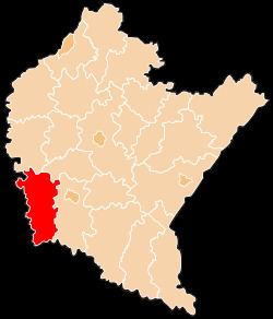
Jasło County (Polish: powiat jasielski) is a unit of territorial administration and local government (powiat) in Subcarpathian Voivodeship, south-eastern Poland, on the Slovak border. It came into being on January 1, 1999, as a result of the Polish local government reforms passed in 1998. Its administrative seat is Jasło, which lies 50 kilometres (31 mi) south-west of the regional capital Rzeszów. The only other town in the county is Kołaczyce, which is 8 km (5.0 mi) north of Jasło.
Contents
Map of Jas%C5%82o County, Poland
The county covers an area of 830.41 square kilometres (320.6 sq mi). As of 2006 its total population was 115,128, out of which the population of Jasło was 37,768, and the rural population was 77,360 (including approximately 1,400 for the population of Kołaczyce, which became a town in 2010).
Neighbouring counties
Jasło County is bordered by Gorlice County to the west, Tarnów County to the north-west, Dębica County to the north, Strzyżów County to the north-east and Krosno County to the east. It also borders Slovakia to the south.
Administrative division
The county is subdivided into 10 gminas (one urban, one urban-rural and eight rural). These are listed in the following table, in descending order of population.
